
 EL NIÑO WATCH: Pacific Heating Up Fast
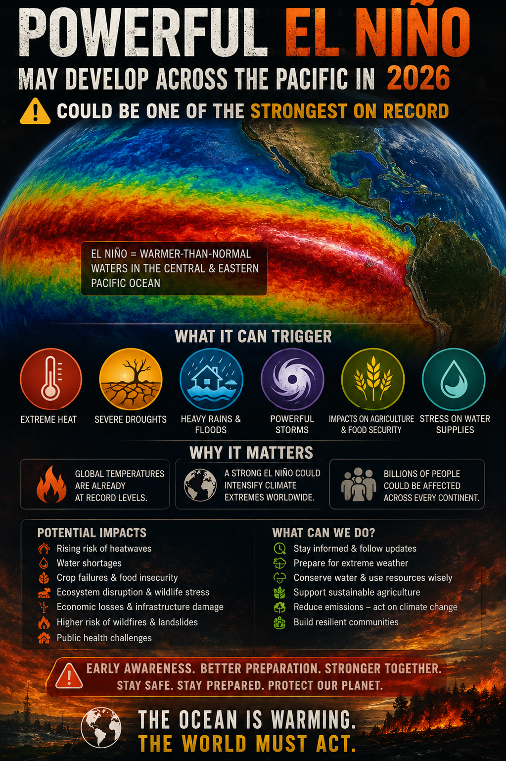
The latest data from NOAA’s Climate Prediction Center shows the tropical Pacific is rapidly moving toward an El Niño pattern.
As of May 14, 2026, CPC gives El Niño an 82% chance of developing between May and July, with a very high chance it continues into the winter of 2026–27.
What We’re Watching
 Rapid Pacific warming
The tropical Pacific is coming out of ENSO-neutral conditions and warming quickly.
 Strong event possible
Several climate models suggest El Niño could strengthen significantly later this year, though the exact intensity is still uncertain.
 Warm water below the surface
A large pocket of warm subsurface water is in place. If westerly wind bursts develop, that heat could surface and help lock in a stronger El Niño.
Why This Matters
This El Niño is developing against a backdrop of very warm global ocean temperatures. That means even a moderate event could help amplify global weather extremes, including heat, drought, flooding, and storm pattern shifts.
For the Gulf Coast, El Niño often becomes more important later in the year and into winter, when it can influence storm tracks, rainfall patterns, and severe weather setups.
Bottom line: El Niño is not officially fully established yet, but the signal is getting stronger fast. This is one to watch closely over the next several weeks.
— Meteorologist Louis Smith
Accurate First Weather