hattiesburg bobby l chain municipal airport weather forecast
| |||||||||


Welcome to Pine Belt Weather Alerts
Pine Belt First Alert Weather provides Weather Forecasts, Updates, and Alerts for the United States including Severe Weather, Winter Weather, and our specialty, Tropical Weather. We run our site on Professionalism and Dedication and are well known for our custom weather graphics and descriptive up-to-the-minute forecasts. Providing accurate, no hype weather information to the public as per of being an Ambassador to the National Weather Service’s Weather-Ready Nation.
Mission: During dangerous weather conditions, not all have access to a TV. With our Facebook awareness posts and dedicated team, we provide a word of the oncoming event with multiple awareness forecasts yet educate them in the process. Our number one goal is to aware with accuracy. What We Do: From forecasts to alerts to free giveaways, Gulf Coast Weather Alerts is your #1 site on Facebook and Twitter to get your weather information. We have proven ourselves in the weather field by the magnitude of fans who follow us including the millions who reached out to us during Hurricanes for the latest forecasts and information.
We specialize in Tropical Weather and live by one sang over “Accuracy over First” -meaning we believe it is important to be accurate on the forecast rather than “first” to predict its track [whether it is right or not]. Here at Gulf Coast Storm Center, you will see the latest Severe Weather Forecasts, Model Predictions, Long Range Forecasts, National Forecasts, Tropical Weather Forecasts, Free Giveaways, Contests, Educational Posts, and More Weather Fun!
Pine Belt Weather is the first and only partnered website along the Gulf Coast to feature both an online weather community, along with a team of Advanced Trained Storm Spotters and Professional Meteorologists all on board for one purpose….to keep you safe and informed, while at the same time inviting you for your opinions and welcoming discussions 24 hours a day, 365 days a year.
.
Categorical Outlook Mississippi Day 1:

Categorical Outlook Mississippi Day 2:

Categorical Outlook Mississippi Day 3:

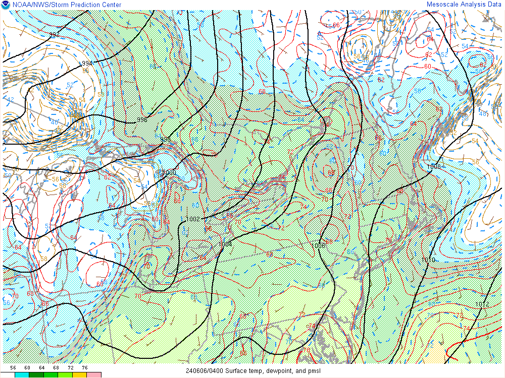
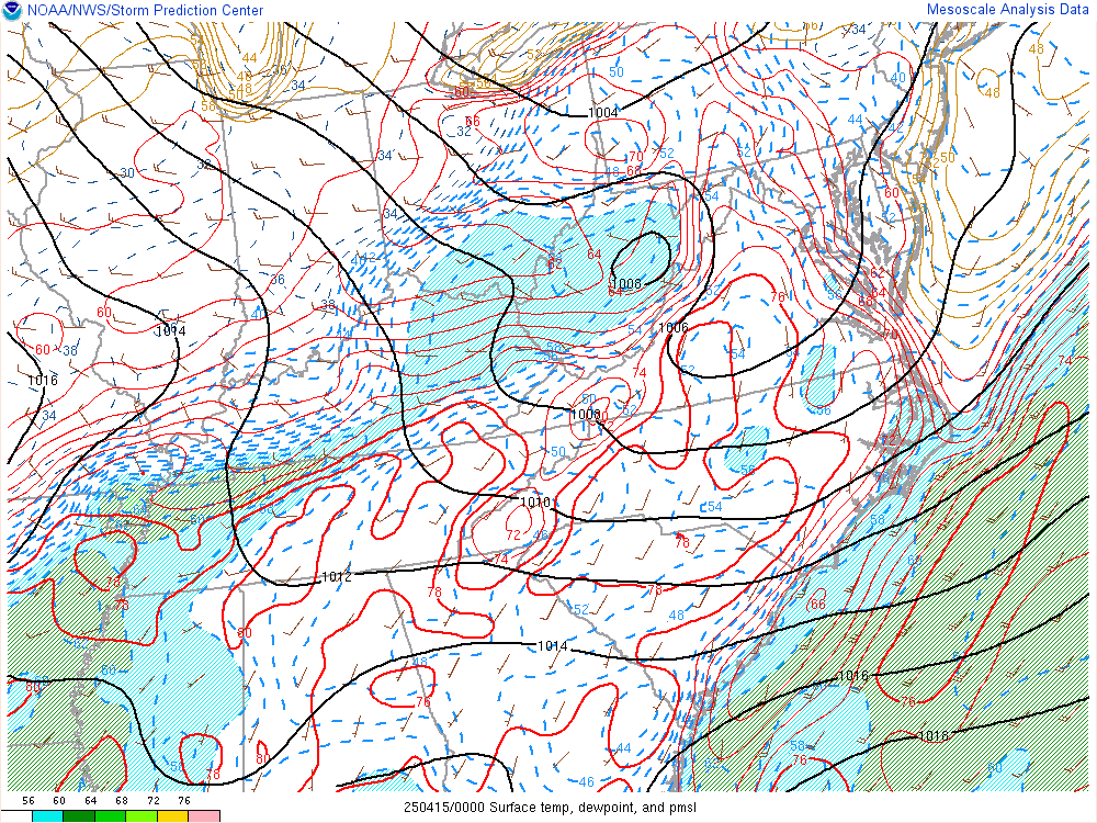
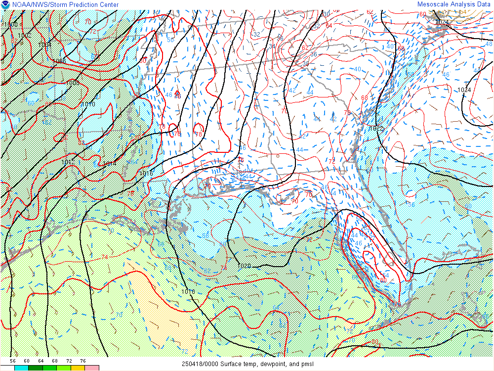
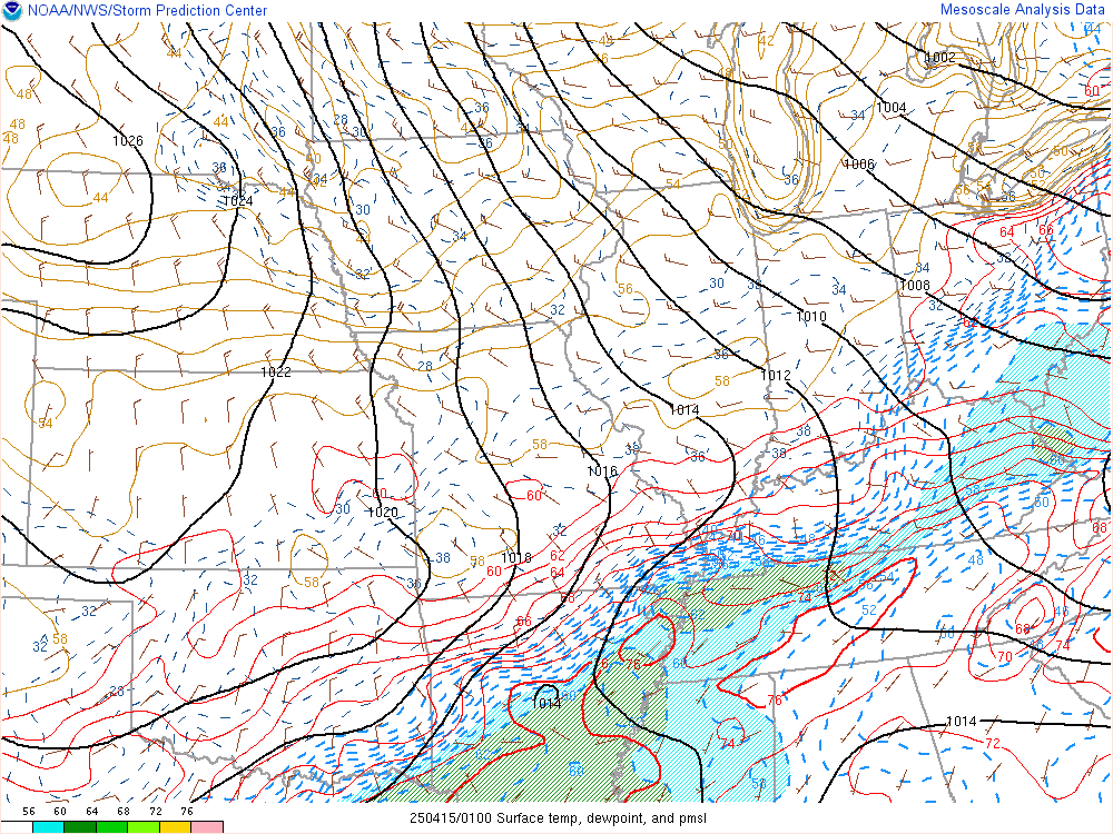
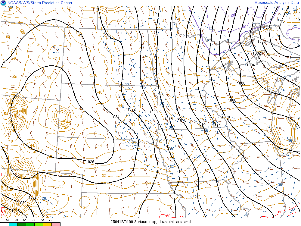
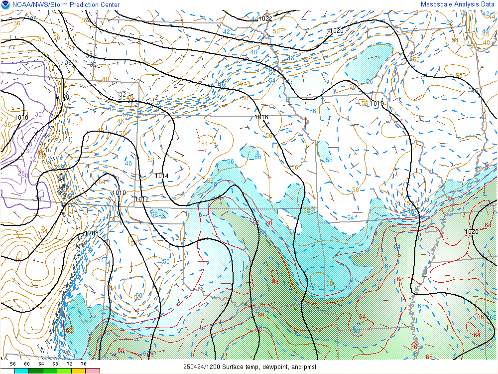
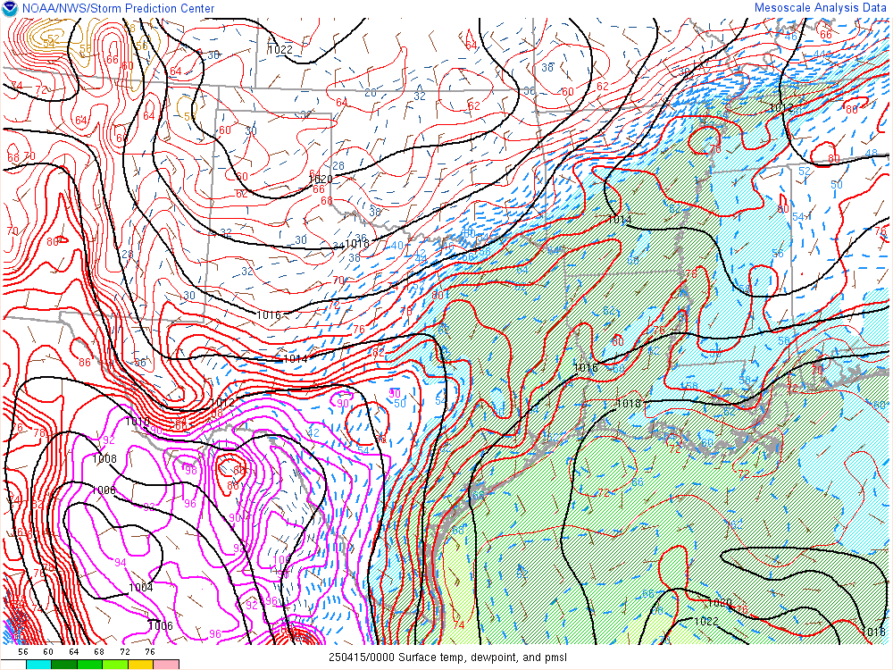
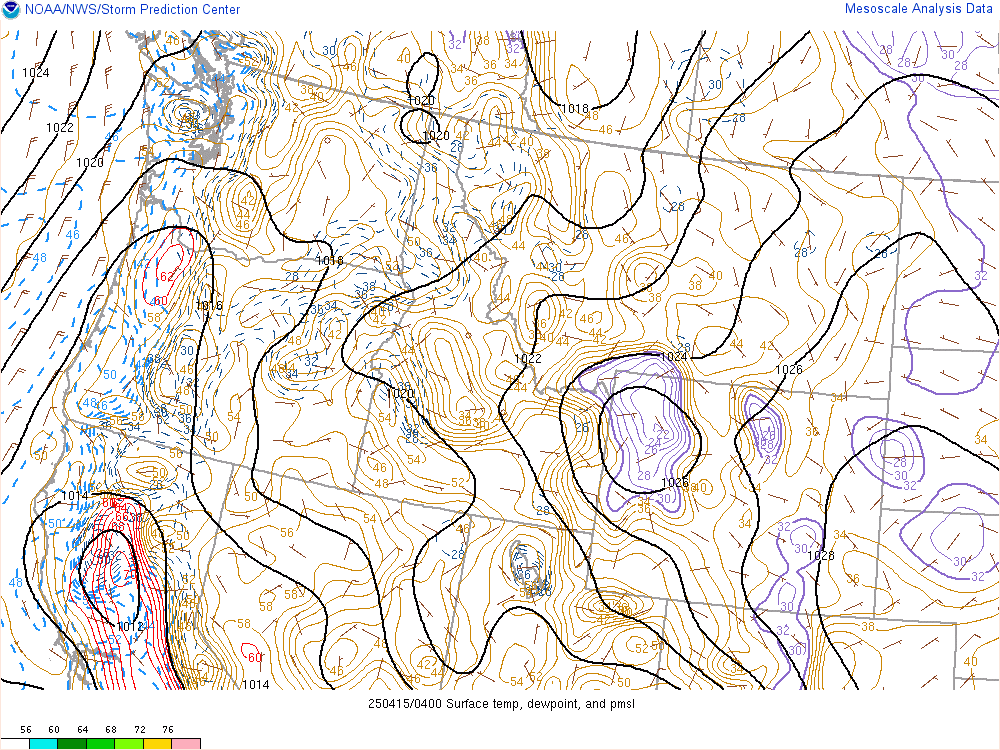
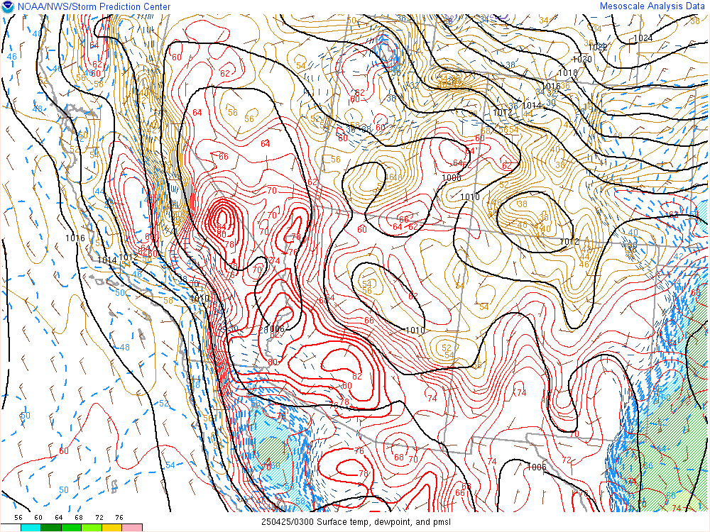
Hourly Mesoscale Analysis
Current Infrared Satellite Images
Latest Tropical Weather Outlook:
Tropical Weather Outlook: 

Current Advisories/Warnings: 
Severe Weather Outlook: 
Satellite Images: 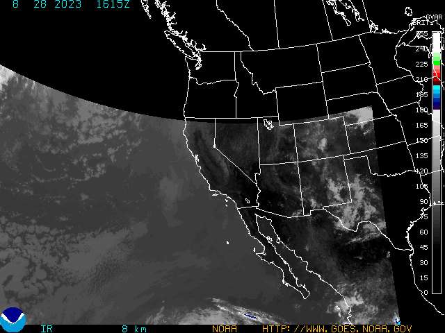

Radar Image: 
Graphical Tropical Weather Discussion:

Latest Tropical Weather Outlook:
Satellite Images:

2 Day Graphical Tropical Weather Outlook:
5 Day Graphical Tropical Weather Outlook:
Latest Tropical Weather Outlook:
Latest Tropical Weather Discussion:
Tropical Atlantic Wide Infrared Satellite Image:


Gulf Of Mexico Infrared Satellite Image:


US East Coast Infrared Satellite Image:

Caribbean Infrared Satellite Image:

Tropical Atlantic Wide Visible Satellite Image:


Gulf Of Mexico Visible Satellite Image:


US East Coast Visible Satellite Image:

Caribbean Visible Satellite Image:

Tropical Atlantic Wide Water Vapor Satellite Image:


Gulf Of Mexico Water Vapor Satellite Image:


US East Coast Water Vapor Satellite Image:

Caribbean Water Vapor Satellite Image:

Eastern Atlantic Infrared Satellite Image:
Eastern Atlantic Infrared Satellite Image:

Eastern Atlantic Visible Satellite Image:

Eastern Atlantic Water Vapor Satellite Image:

Radar Imagery:
Northeastern United States:

Southeast United States:

Lower Mississippi Valley:

Southern Plains:


Current Cayman Islands Radar Image:


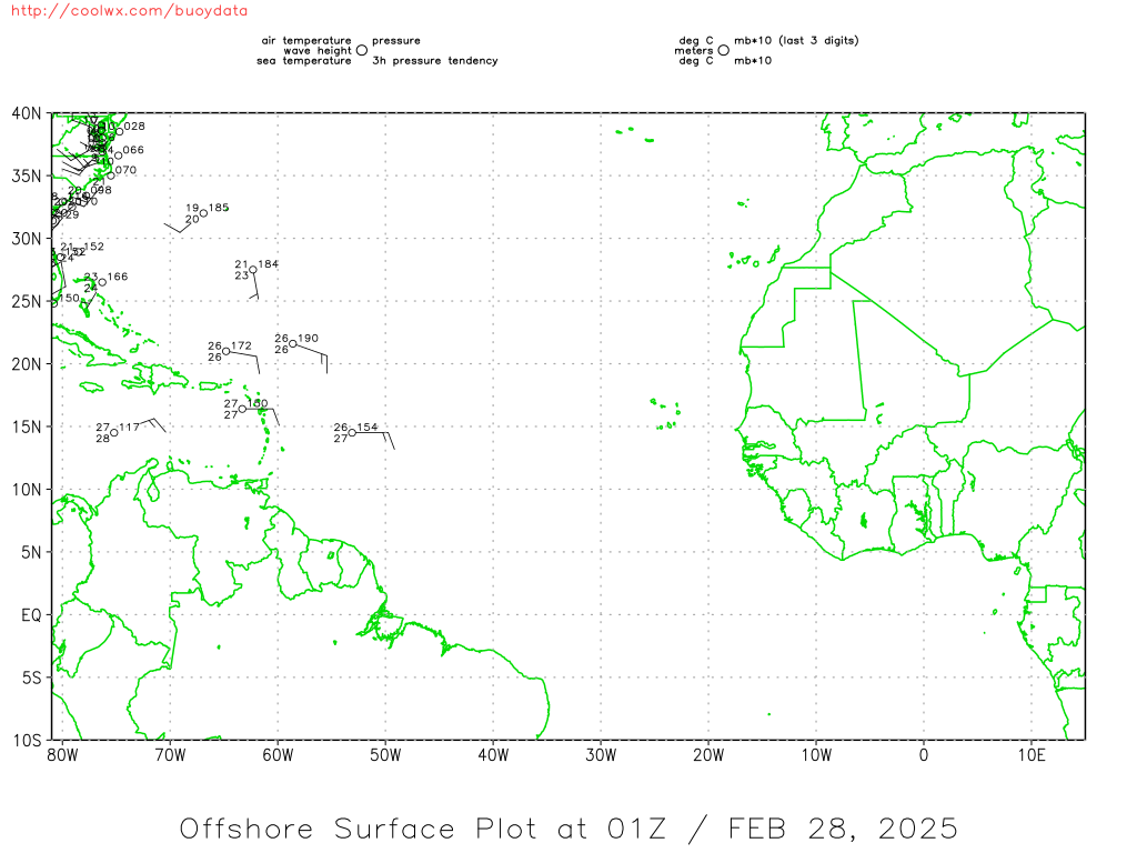
Current Southwest North Atlantic Surface Analysis:

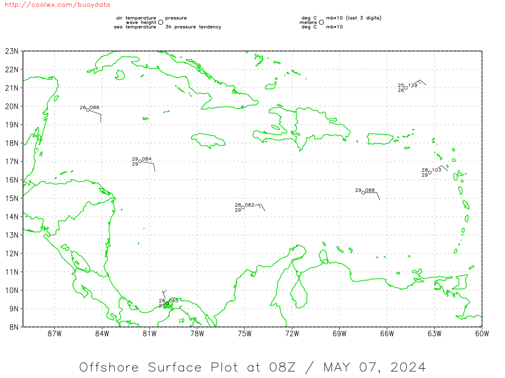
Current Caribbean Surface Analysis:

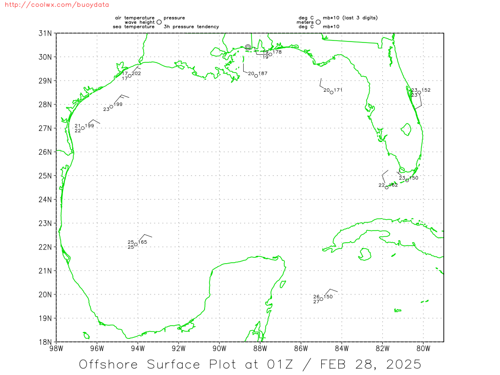
Current Gulf of Mexico Surface Analysis:

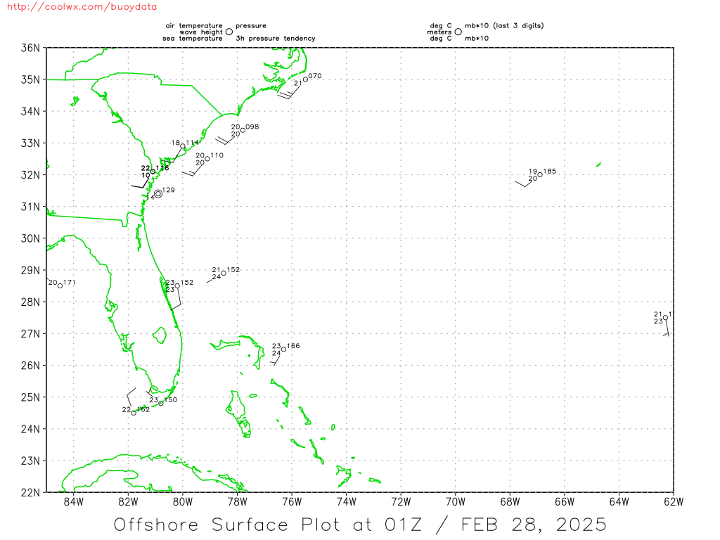
Current Southeast US Surface Map:

Current Northern/Western Gulf Coast Surface Map:

Western Atlantic Wind and Wave Analysis:

Current Atlantic Sea State Analysis:

24 Hour NHC Surface Forecast:

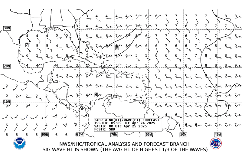
24 Hour NHC Wind & Wave Forecast:
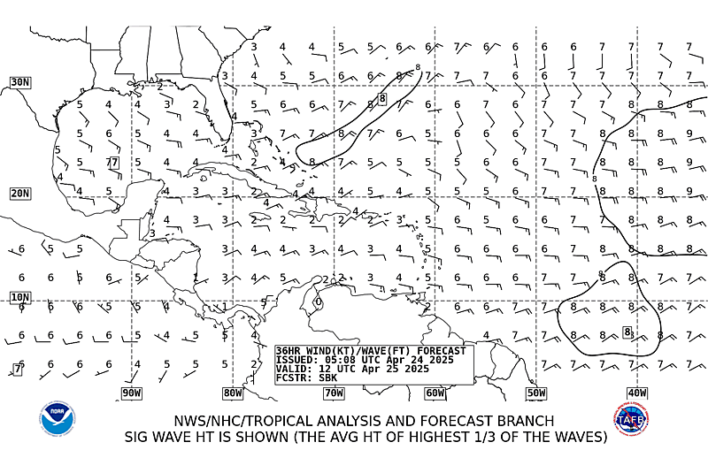
36 Hour NHC Wind & Wave Forecast:
48 Hour NHC Surface Forecast:

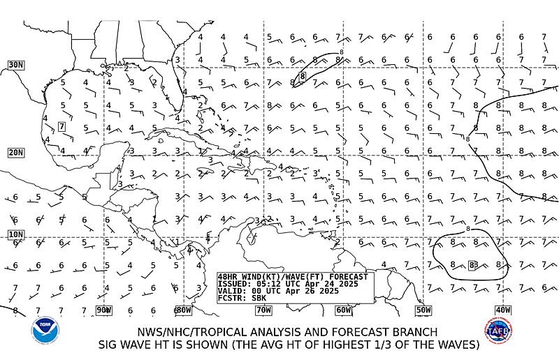
48 Hour NHC Wind & Wave Forecast:
72 Hour NHC Surface Forecast:

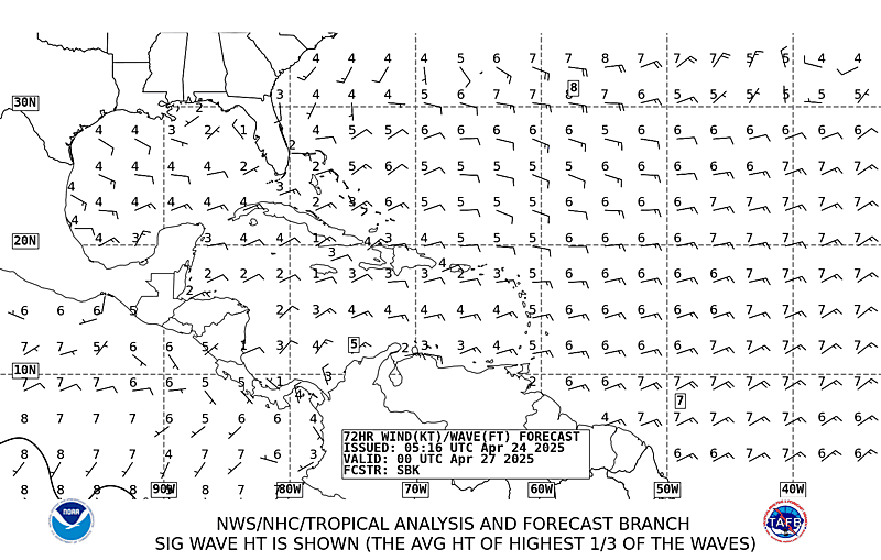
72 Hour NHC Wind & Wave Forecast:
Day 3 Forecast Surface Weather Map:
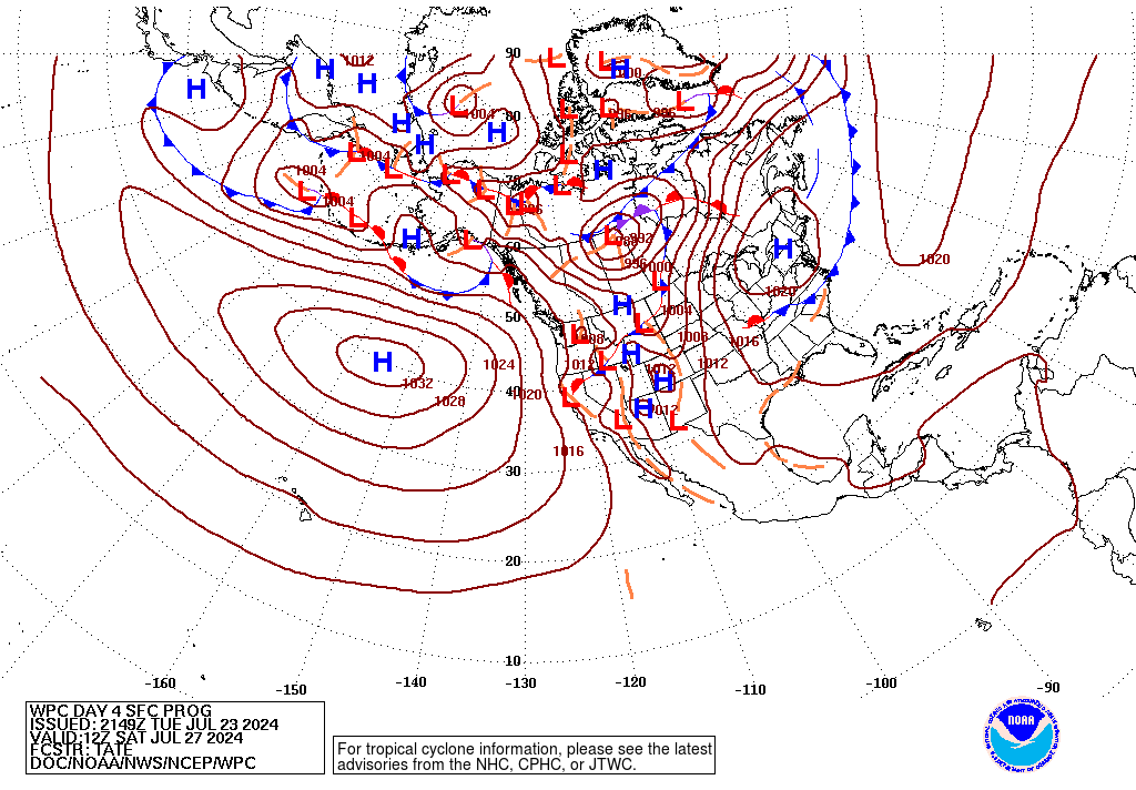
Day 4 Forecast Surface Weather Map:
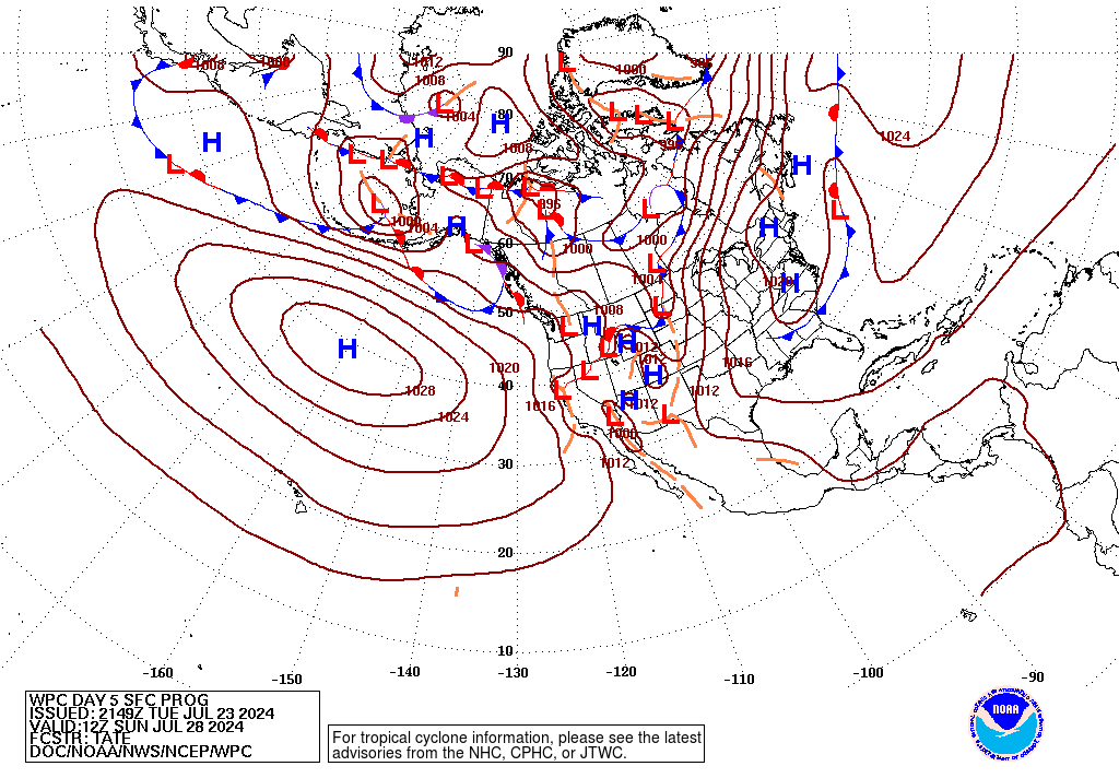
Day 5 Forecast Surface Weather Map:
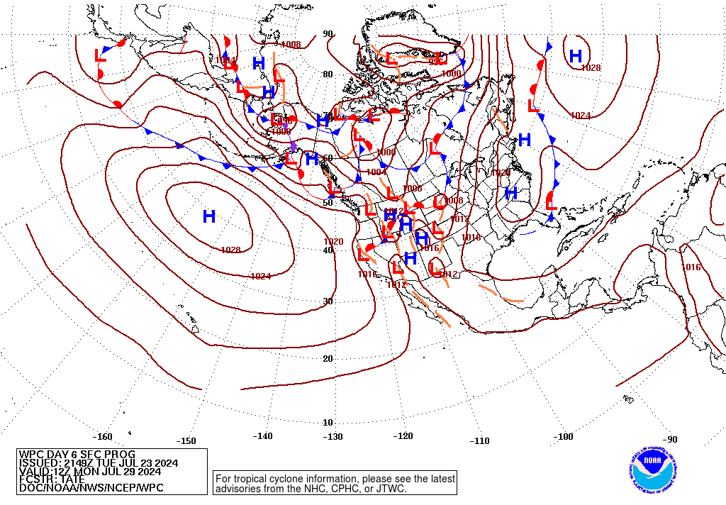
Day 6 Forecast Surface Weather Map:
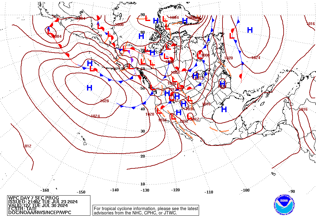
Day 7 Forecast Surface Weather Map: