
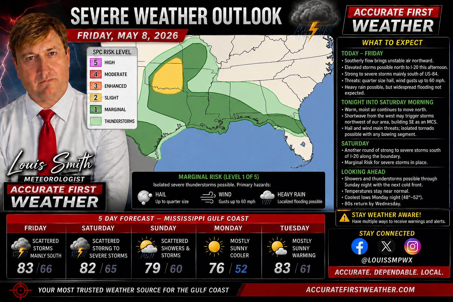
For today, Friday, May 8, 2026, the Storm Prediction Center (SPC) has moved the primary severe threat further south and east as a cold front continues to sag toward the coast.
Severe Weather Outlook
A Marginal Risk (Level 1 of 5) is in place for portions of the central Gulf Coast, including Southern Mississippi, Southern Louisiana, and Southern Alabama.
• Primary Hazards: The main concerns for today are marginally severe hail and isolated damaging wind gusts.
• Tornado Threat: The risk for tornadoes has significantly diminished compared to earlier in the week, with probabilities generally remaining below the 2% threshold for most of the region.
• Timing: Activity is expected to peak during the afternoon and evening hours as weather disturbances move across the stalled frontal boundary.
Hydrologic Concerns
While the severe threat is lower today, the Weather Prediction Center (WPC) has maintained a Marginal Risk for Excessive Rainfall across the region. With high precipitable water values and a quasi-stationary front, persistent thunderstorms could lead to localized training and street flooding, particularly in urban areas and low-lying spots along the Gulf Coast.
Conditions are expected to remain unsettled through Saturday before a drier air mass begins to push in from the north.