![](https://www.gulfcoasthurricanecenter.com/wp-content/uploads/2018/12/sunnypinebeltradio.jpg)
![](https://www.cordovaradio.com/onair.big.gif)
|
Welcome to Pine Belt Weather Alerts
Pine Belt Weather Alerts is your one-stop weather information source by providing the latest and most up-to-date weather data, including Tropical Weather Information, Caribbean Weather Information, Mississippi Weather Information, Southern US Weather, Northeastern US Weather Information, Severe Weather Information, and National Weather Information.
Latest Tropical Weather Outlook:
Categorical Outlook Mississippi Day 1:
![](https://www.spc.noaa.gov/public/state/images/MS_swody1.png)
Categorical Outlook Mississippi Day 2:
![](https://www.spc.noaa.gov/public/state/images/MS_swody2.png)
Categorical Outlook Mississippi Day 3:
![](https://www.spc.noaa.gov/public/state/images/MS_swody3.png)
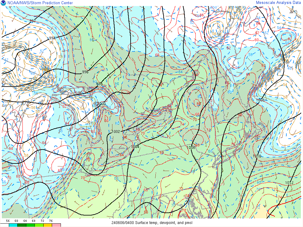
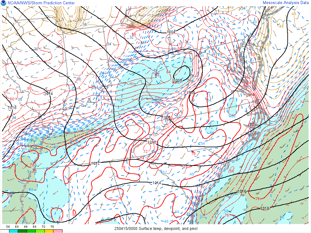
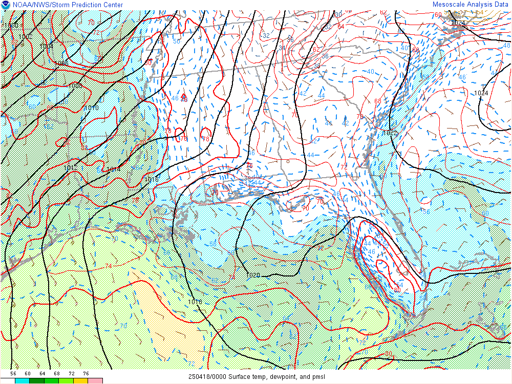
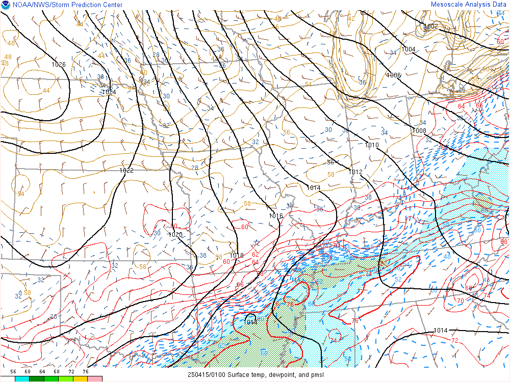
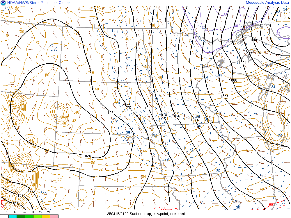
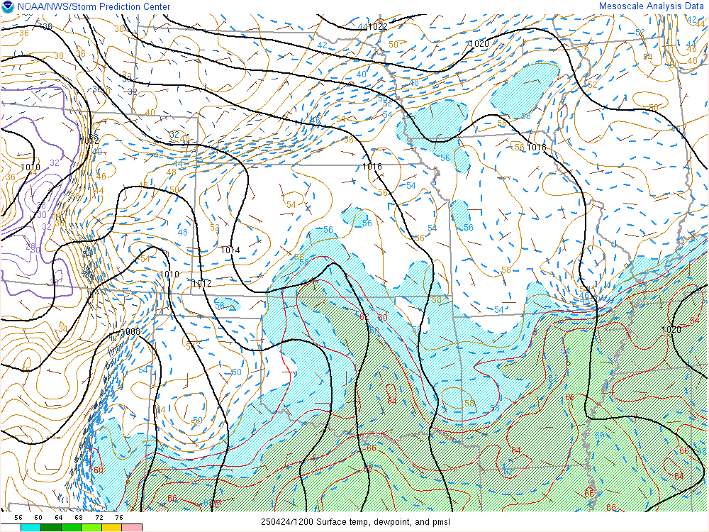
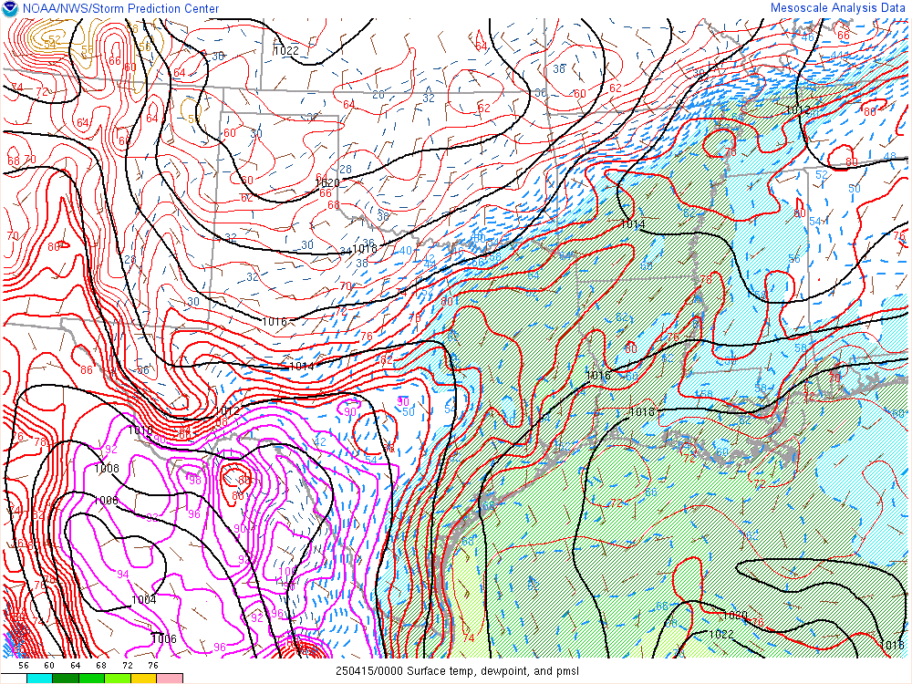
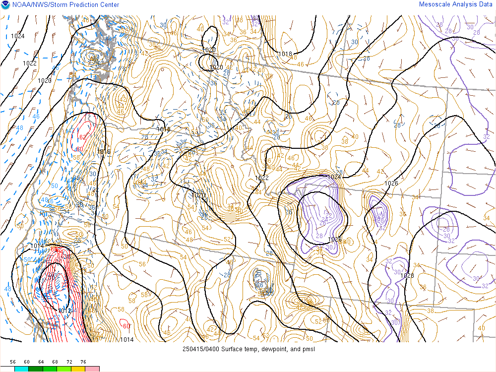
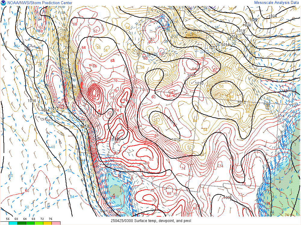
Hourly Mesoscale Analysis
![](https://www.spc.noaa.gov/exper/mesoanalysis/s16/ttd/ttd.gif)
![](https://www.spc.noaa.gov/exper/mesoanalysis/s17/ttd/ttd.gif)
![](https://www.spc.noaa.gov/exper/mesoanalysis/s18/ttd/ttd.gif)
![](https://www.spc.noaa.gov/exper/mesoanalysis/s20/ttd/ttd.gif)
![](https://www.spc.noaa.gov/exper/mesoanalysis/s13/ttd/ttd.gif)
![](https://www.spc.noaa.gov/exper/mesoanalysis/s14/ttd/ttd.gif)
![](https://www.spc.noaa.gov/exper/mesoanalysis/s15/ttd/ttd.gif)
![](https://www.spc.noaa.gov/exper/mesoanalysis/s11/ttd/ttd.gif)
![](https://www.spc.noaa.gov/exper/mesoanalysis/s12/ttd/ttd.gif)
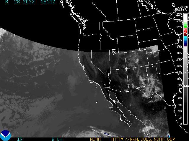
Current Infrared Satellite Images
2 Day Graphical Tropical Weather Outlook:
![](https://www.nhc.noaa.gov/xgtwo/two_atl_2d0.png)
5 Day Graphical Tropical Weather Outlook:
![](https://www.nhc.noaa.gov/xgtwo/two_atl_5d0.png)
Latest Tropical Weather Outlook:
Latest Tropical Weather Discussion:
Tropical Atlantic Wide Infrared Satellite Image:
![Courtesy of College of Dupage](https://weather.cod.edu/data/satellite/global/atlantic/current/atlantic.14.jpg)
![Courtesy of NOAA NESDIS](https://cdn.star.nesdis.noaa.gov/GOES16/ABI/SECTOR/taw/14/900x540.jpg)
Gulf Of Mexico Infrared Satellite Image:
![Courtesy of College of Dupage](https://weather.cod.edu/data/satellite/regional/gulf/current/gulf.14.jpg)
![Courtesy of NOAA NESDIS](https://cdn.star.nesdis.noaa.gov/GOES16/ABI/SECTOR/gm/14/1000x1000.jpg)
US East Coast Infrared Satellite Image:
![Courtesy of NOAA NESDIS](https://cdn.star.nesdis.noaa.gov/GOES16/ABI/SECTOR/eus/14/1000x1000.jpg)
Caribbean Infrared Satellite Image:
![Courtesy of NOAA NESDIS](https://cdn.star.nesdis.noaa.gov/GOES16/ABI/SECTOR/car/14/1000x1000.jpg)
Tropical Atlantic Wide Visible Satellite Image:
![Courtesy of College of Dupage](https://weather.cod.edu/data/satellite/global/atlantic/current/atlantic.02.jpg)
![Courtesy of NOAA NESDIS](https://cdn.star.nesdis.noaa.gov/GOES16/ABI/SECTOR/taw/02/900x540.jpg)
Gulf Of Mexico Visible Satellite Image:
![Courtesy of College of Dupage](https://weather.cod.edu/data/satellite/regional/gulf/current/gulf.02.jpg)
![Courtesy of NOAA NESDIS](https://cdn.star.nesdis.noaa.gov/GOES16/ABI/SECTOR/gm/02/1000x1000.jpg)
US East Coast Visible Satellite Image:
![Courtesy of NOAA NESDIS](https://cdn.star.nesdis.noaa.gov/GOES16/ABI/SECTOR/eus/02/1000x1000.jpg)
Caribbean Visible Satellite Image:
![Courtesy of NOAA NESDIS](https://cdn.star.nesdis.noaa.gov/GOES16/ABI/SECTOR/car/02/1000x1000.jpg)
Tropical Atlantic Wide Water Vapor Satellite Image:
![Courtesy of College of Dupage](https://weather.cod.edu/data/satellite/global/atlantic/current/atlantic.08.jpg)
![Courtesy of NOAA NESDIS](https://cdn.star.nesdis.noaa.gov/GOES16/ABI/SECTOR/taw/08/900x540.jpg)
Gulf Of Mexico Water Vapor Satellite Image:
![Courtesy of College of Dupage](https://weather.cod.edu/data/satellite/regional/gulf/current/gulf.08.jpg)
![Courtesy of NOAA NESDIS](https://cdn.star.nesdis.noaa.gov/GOES16/ABI/SECTOR/gm/08/1000x1000.jpg)
US East Coast Water Vapor Satellite Image:
![Courtesy of NOAA NESDIS](https://cdn.star.nesdis.noaa.gov/GOES16/ABI/SECTOR/eus/08/1000x1000.jpg)
Caribbean Water Vapor Satellite Image:
![Courtesy of NOAA NESDIS](https://cdn.star.nesdis.noaa.gov/GOES16/ABI/SECTOR/car/08/1000x1000.jpg)
Eastern Atlantic Infrared Satellite Image:
![Courtesy of College of Dupage](https://weather.cod.edu/data/satellite/global/capeverde/current/capeverde.14.jpg)
Eastern Atlantic Visible Satellite Image:
![Courtesy of College of Dupage](https://weather.cod.edu/data/satellite/global/capeverde/current/capeverde.02.jpg)
Eastern Atlantic Water Vapor Satellite Image:
![Courtesy of College of Dupage](https://weather.cod.edu/data/satellite/global/capeverde/current/capeverde.08.jpg)
Radar Imagery:
Northeastern United States:
![](https://radar.weather.gov/ridge/Conus/Loop/northeast_loop.gif)
Southeast United States:
![](https://radar.weather.gov/ridge/Conus/Loop/southeast_loop.gif)
Lower Mississippi Valley:
![](https://radar.weather.gov/ridge/Conus/Loop/southmissvly_loop.gif)
Southern Plains:
![](https://radar.weather.gov/ridge/Conus/Loop/southplains_loop.gif)
![](https://radar.weather.gov/ridge/lite/N0Z/JUA_loop.gif)
Current Cayman Islands Radar Image:
![](https://www.gov.ky/radar_images/radar/400km_ppi.gif)
![Courtesy of NOAA Ocean Prediction Center](https://www.opc.ncep.noaa.gov/UA/Atl_Tropics.gif)
![Courtesy of coolwx.com](https://coolwx.com/buoydata/data/curr/atl-mid.png)
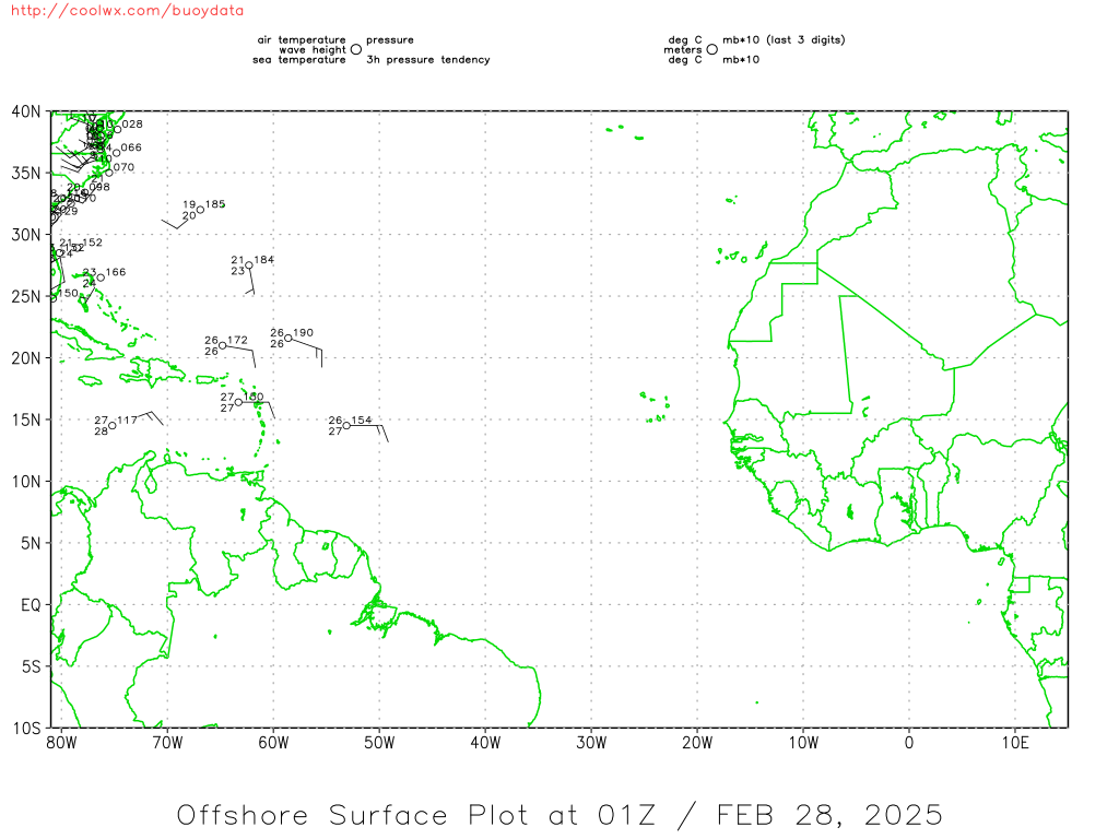
Current Southwest North Atlantic Surface Analysis:
![Courtesy of the National Hurricane Center](https://www.nhc.noaa.gov/tafb_latest/WATL_latest.gif)
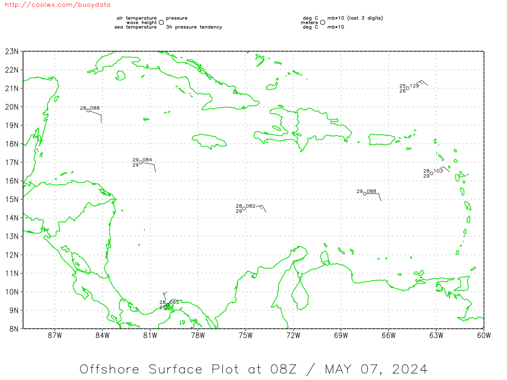
Current Caribbean Surface Analysis:
![Courtesy of the National Hurricane Center](https://www.nhc.noaa.gov/tafb_latest/CAR_latest.gif)
![Courtesy of coolwx.com](https://coolwx.com/buoydata/data/curr/carib.png)
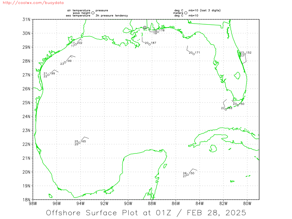
Current Gulf of Mexico Surface Analysis:
![Courtesy of the National Hurricane Center](https://www.nhc.noaa.gov/tafb_latest/GULF_latest.gif)
![Courtesy of coolwx.com](https://coolwx.com/buoydata/data/curr/gulf.png)
![Courtesy of coolwx.com](https://coolwx.com/buoydata/data/curr/atl-seus.png)
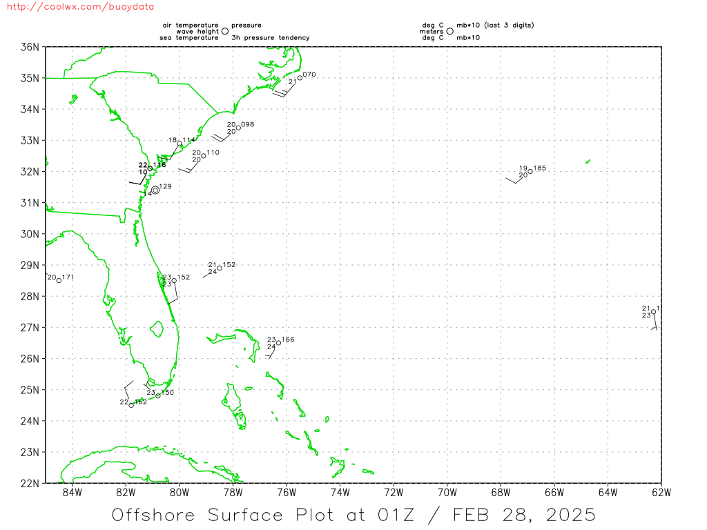
Current Southeast US Surface Map:
![](https://www.wpc.ncep.noaa.gov/sfc/namsesfcwbg.gif)
Current Northern/Western Gulf Coast Surface Map:
![](https://www.wpc.ncep.noaa.gov/sfc/namscsfcwbg.gif)
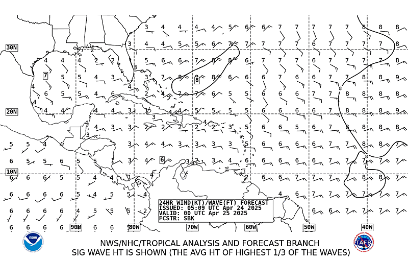
Western Atlantic Wind and Wave Analysis:
![](https://www.opc.ncep.noaa.gov/shtml/ra1.gif)
Current Atlantic Sea State Analysis:
![Courtesy of the National Hurricane Center](https://www.nhc.noaa.gov/tafb_latest/atlsea_latestBW.gif)
24 Hour NHC Surface Forecast:
![Courtesy of the National Hurricane Center](https://www.nhc.noaa.gov/tafb_latest/atlsfc24_latestBW_sm3.gif)
24 Hour NHC Wind & Wave Forecast:
![](https://www.nhc.noaa.gov/tafb_latest/atl24_latestBW_sm3.gif)
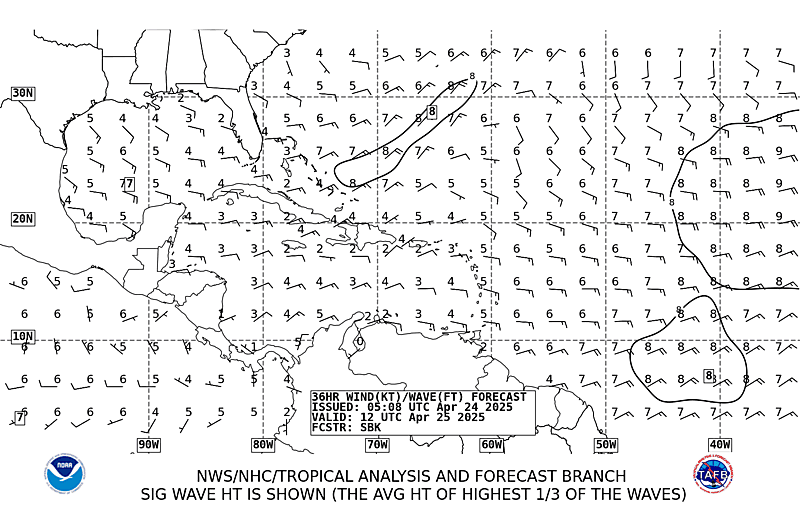
36 Hour NHC Wind & Wave Forecast:
![](https://www.nhc.noaa.gov/tafb_latest/atl36_latestBW_sm3.gif)
48 Hour NHC Surface Forecast:
![Courtesy of the National Hurricane Center](https://www.nhc.noaa.gov/tafb_latest/atlsfc48_latestBW_sm3.gif)
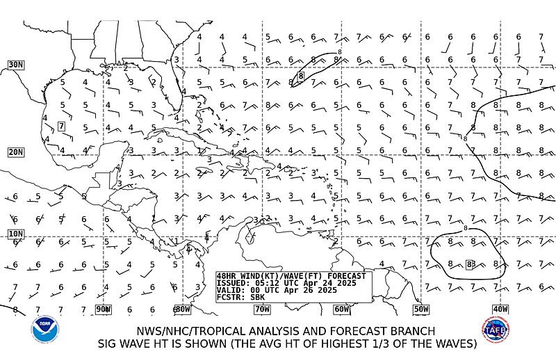
48 Hour NHC Wind & Wave Forecast:
![](https://www.nhc.noaa.gov/tafb_latest/atl48_latestBW_sm3.gif)
72 Hour NHC Surface Forecast:
![Courtesy of the National Hurricane Center](https://www.nhc.noaa.gov/tafb_latest/atlsfc72_latestBW_sm3.gif)
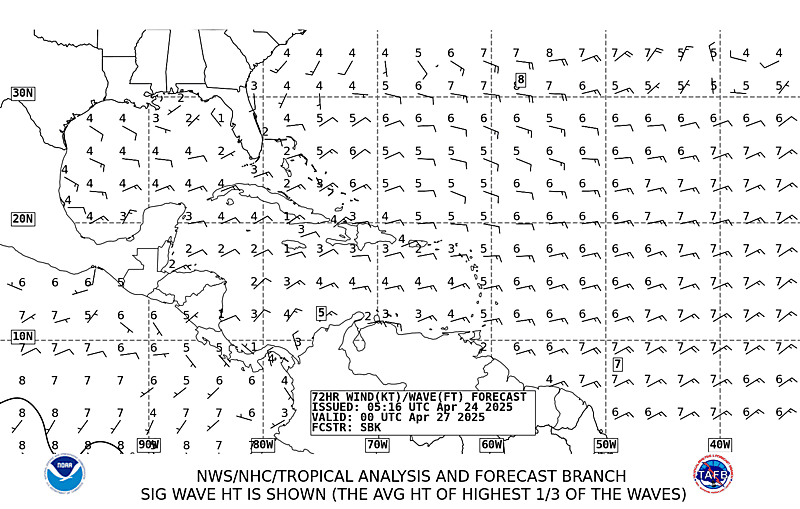
72 Hour NHC Wind & Wave Forecast:
![](https://www.nhc.noaa.gov/tafb_latest/atl72_latestBW_sm3.gif)
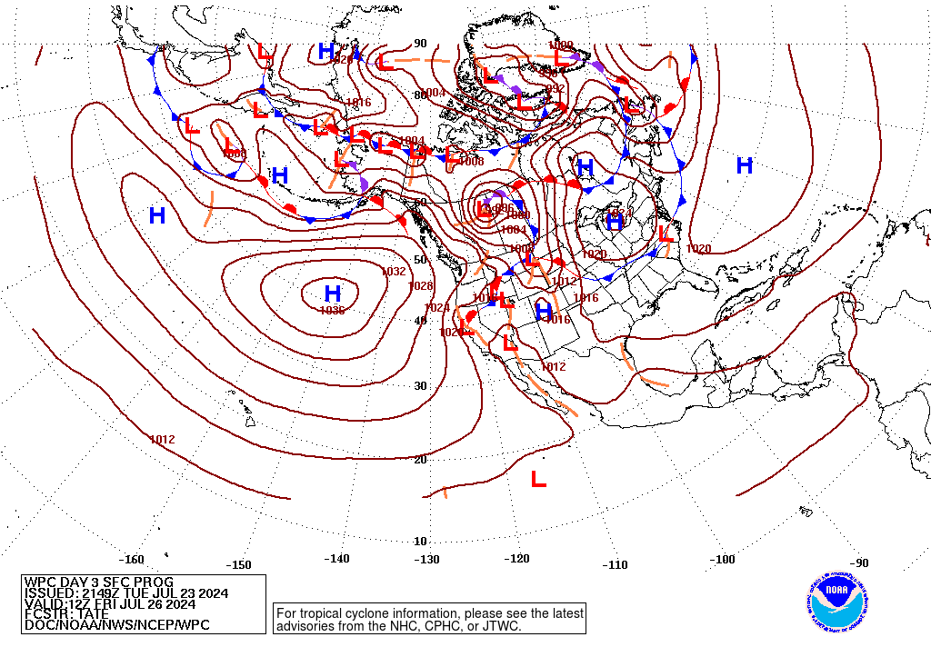
Day 3 Forecast Surface Weather Map:
![](https://www.wpc.ncep.noaa.gov/medr/9jhwbg_crop.gif)
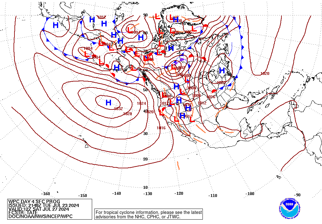
Day 4 Forecast Surface Weather Map:
![](https://www.wpc.ncep.noaa.gov/medr/9khwbg_crop.gif)
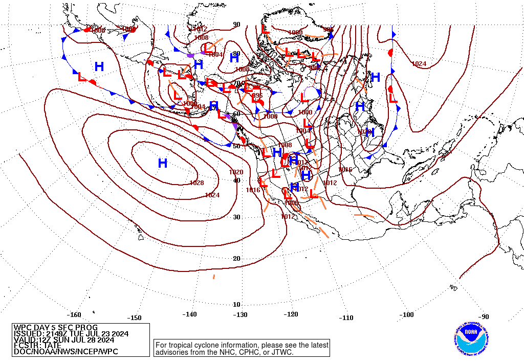
Day 5 Forecast Surface Weather Map:
![](https://www.wpc.ncep.noaa.gov/medr/9lhwbg_crop.gif)
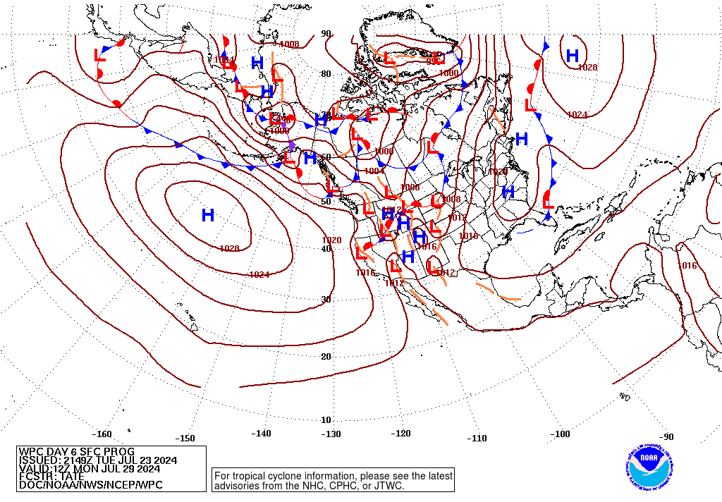
Day 6 Forecast Surface Weather Map:
![](https://www.wpc.ncep.noaa.gov/medr/9mhwbg_crop.gif)
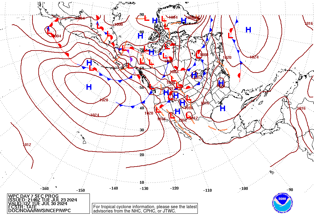
Day 7 Forecast Surface Weather Map:
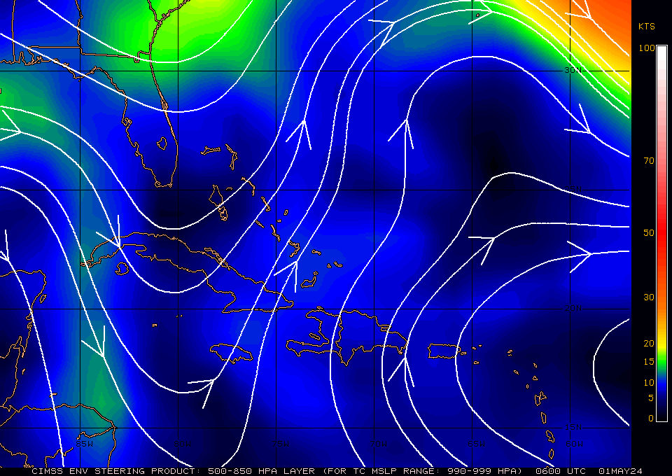
![](https://www.wpc.ncep.noaa.gov/medr/9nhwbg_crop.gif)