

If you live or work near the Atlantic or Gulf coasts, listen up: Some scientists are predicting this year’s hurricane season will be extremely active. They include Ryan Truchelut, the chief meteorologist at Weather Tiger in Tallahassee, Florida, who recently spoke with Living on Earth about what we can expect this hurricane season.
This interview has been edited for length and clarity.
STEVE CURWOOD: The formal start of the Atlantic hurricane season begins in June. Look into your crystal ball: What are the indicators that you see that can give us a good prediction for this coming summer when it comes to those hurricanes?
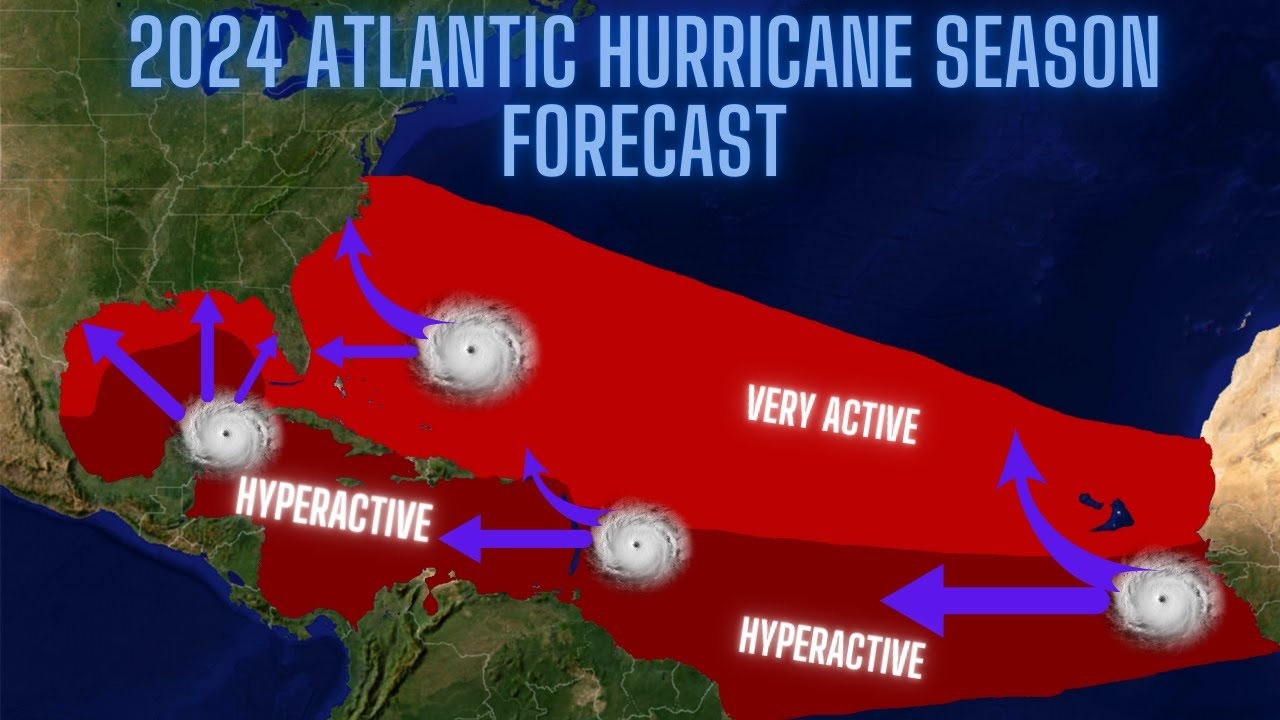
RYAN TRUCHELUT: When you’re making a forecast for the hurricane season’s overall activity in March or April, there’s really two main predictors that you look at at this time range. Those are, is the Pacific going to be in an El Niño or La Niña? And how warm is the tropical Atlantic Ocean? And right now, unfortunately, both of those factors are likely to be very favorable for highly elevated Atlantic hurricane activity in the 2024 season.
CURWOOD: Sea surface temperatures are hotter. How much hotter?
TRUCHELUT: They’ve been breaking records here as we’ve gone through winter 2023-24. They were very, very hot during the 2023 hurricane season, and they never really cooled off. So the average temperature in the tropical Atlantic, the region that we watch for hurricane development as the season rolls forward, has been about a third to half a degree warmer than it ever has been previously in the northern hemisphere winter.
CURWOOD: It’s changing now from El Niño to La Niña, as you say. What does that do to hurricanes?
TRUCHELUT: Unfortunately, that is also very favorable for hurricane development in the Caribbean Sea, the western Atlantic, and the Gulf of Mexico. People often ask me, why does it matter what’s happening in the Pacific, when we’re looking at the Atlantic? Well, El Niño and La Niña really set the tone for weather patterns worldwide.
When the waters of the Central Pacific near the equator are warmer than average and we’re in an El Niño, that results in a weather pattern that results in unfavorably strong upper-level winds over the western Caribbean and the western Atlantic that are unfavorable for hurricane development. When there is an active El Niño, the Atlantic hurricane season tends to be quieter than normal.
In La Niña, when the waters of the Central Pacific near the equator are cooler than average, it’s just the opposite. Those upper-level winds are lighter than average over the Caribbean and the Gulf of Mexico. That’s favorable for tropical storms to develop and intensify. Unfortunately, that means it’s often a busier than average hurricane season in the Atlantic when a La Niña is going on.
CURWOOD: Last year, we had the El Niño and still there were some pretty tough hurricanes that hit the Gulf of Mexico and Florida. It sounds to me with La Niña switching on, it’s like adding steroids to the system.
TRUCHELUT: Right. Last year, the 2023 hurricane season was a real conundrum for hurricane forecasters, because we’d never faced such a divergence in those two key predictors. Atlantic sea surface temperatures were very, very warm. Record warmth far above average. But at the same time, we were looking at the development of a pretty strong El Niño in the Pacific. So there was a real question in the hurricane research community and hurricane forecaster community of which of those influences was going to win out.
In the end, it was a busier than average hurricane season, about a third more active than average. Fortunately, most of that activity stayed out to sea in the central Atlantic. But as you point out, I’m in North Florida. We had to deal with a threat from category four Hurricane Idalia in late August. It’s very unusual for the Gulf Coast to be threatened by a category four hurricane during a strong El Niño year. But it’s that offsetting Atlantic warmth that really gave some of the storms an extra boost last year.
CURWOOD: Now we’re going to move into a situation where those accelerators, those additive factors are coming together, a warmer ocean and a La Niña. Crack open your history book for us for a moment. Talk to me about some of the past years that have had similar conditions to the ones that you’re seeing for this upcoming 2024 season. How did those years fare?
TRUCHELUT: In the past few decades, we do have a couple other years that we can use as reference points. The key ones are 1998, 2010 and 2020. All three of those seasons you started out the year with an ongoing El Niño. That El Niño weakened and dissipated by the summer months and was replaced by a La Niña in the fall. The Atlantic sea surface temperatures were also warmer than average in those key development regions in each of those three years. Now, not quite as warm as we are right now in 2024. But certainly warmer than average. All three of those years were significantly more active than a normal Atlantic hurricane season, more active by about 75 percent.
All three of them had essentially the same amount of overall activity. But if there’s something that’s a little bit comforting to take away from this, it’s that those three years had very different outcomes in terms of impacts on the continental United States, as well as populated areas bordering the Caribbean and in Central America and Mexico.
In the 1998 hurricane season, the United States saw three hurricane landfalls, but no major hurricane landfalls. We did see Hurricane Mitch, which was a horrible storm for Central America, one of the worst of all time in the Caribbean.
In the 2010 hurricane season, we saw next to no impacts in the continental United States. We did see some hurricane landfalls in the Caribbean and in Central America, but it was a light year for the United States even though there were a lot of hurricanes out in the open waters.
Unfortunately, 2020 was a very, very busy hurricane season. Not only did we have the most named storms ever on record, with 30, but we saw seven major hurricanes, and numerous landfalls along the Gulf of Mexico coast, including Category Four Hurricane Laura. And we also saw horrific storms in Central America going into October and November of that year. We had Eta and Iota off the Greek name list that just pummeled Central America deep into November. So there’s a range of outcomes still on the table. Just because it’s an active hurricane season doesn’t necessarily mean that it’ll be a very busy one for the United States. But it certainly does raise the baseline risks when there’s more activity.
CURWOOD: It looks like conditions are right for a hyperactive season this year. What will meteorologists, folks like you, be watching out for as we get closer to June?
TRUCHELUT: Well, we’ll be watching to see if there’s any changes in the depth or the extent of that warmth over the tropical Atlantic. Those sea surface temperatures can change with time. They can warm up, they can cool down. They can pivot pretty quickly as trade winds shift.
I will say it’s going to be difficult to pull back the warmth. We’re so far above average that even if they cooled off, we’d still probably be well above average for the season, heading into the peak of the season, even if we don’t warm up quite on the rate that we have been.
We’ll also watch to see how La Niña is developing in the Pacific. Right now, there’s every indication that El Niño will be ending over the next month or so. We’ll be proceeding pretty quickly through neutral conditions and then into La Niña by the end of the summer.
But if that changes, if there’s a delay or we don’t see La Niña developing quite as quickly—as many of the models now suggest—that too, would change the risk profile somewhat.
Overall, the way that I phrased this in my seasonal outlook is that we’re very likely to have an above average hurricane season. That’s almost baked in at this point. But we don’t know if we are going to have a size L hurricane season, or are we going to have a size XXXL? How many extra larges are we going to have in terms of impacts? That’s still up in the air.
CURWOOD: What should people know about preparing for a season with this elevated risk?
TRUCHELUT: People who live along the coast need to have a plan for what they would do if a major hurricane is heading in their direction. Once the watches and warnings go up, once you receive evacuation orders from local emergency management, you need to know what you would do in that circumstance, where you would go.
In many cases when you receive an evacuation order, you don’t need to flee to another state. You just need to move far enough inland so that you’re above the dangerous floodwaters and surge waters that are occurring along the immediate coastline. So know your surge zone, know your evacuation zone and be ready with a plan to heed that order when the time comes. Because that will save your life. You can hide from wind, but you need to run from water.
CURWOOD: The media often focuses on the speed of the hurricane. But I gather from your work the storm surge is a much bigger risk to people.
TRUCHELUT: That’s true. For a long time we focused on wind. Wind is how we categorize and classify hurricanes. The Saffir-Simpson Hurricane Wind Scale is completely based on the maximum sustained wind. Now, maximum sustained wind only occurs in a tiny sliver of a hurricane’s eyewall. And really, that maximum wind is only occurring offshore.
Any time a hurricane moves over land, the friction between the wind and the trees and the buildings slows down those maximum sustained winds. That’s really not the right focus to have as we’re holistically evaluating the total threat that a hurricane poses to life and property.
Now, wind is a serious risk. I don’t want to play that down. It certainly does quite a bit of damage when a major hurricane makes landfall. But only about 10 percent of the deaths and casualties in a hurricane are caused by wind itself. The vast majority of damage and casualties are caused by flooding and storm surge flooding, river flooding, excessive precipitation, as well as the wind pushing those waters on shore.
As hurricane forecasters, and risk communicators, science communicators, we’re trying to move away from the category of a storm and think about all the different threats that a hurricane poses whether it be wind, surge, flooding or tornado threats.