
The first in a series of strong Pacific storms is impacting parts of the Pacific Northwest this evening, and several more are set to bring similar impacts through the coming week. For each system, the coastline will see heavy rain and strong winds, with the higher terrain of the Cascades seeing precip fall in the form of heavy snow. High surf will also cause problems along the immediate shorelines in terms of beach erosion and potentially minor coastal flooding. So what’s behind these storms, and when are the next set to arrive?
Here’s a look at the general pattern across the Northern Hemisphere both at about 25,000 feet (500mb) and way up in the stratosphere.
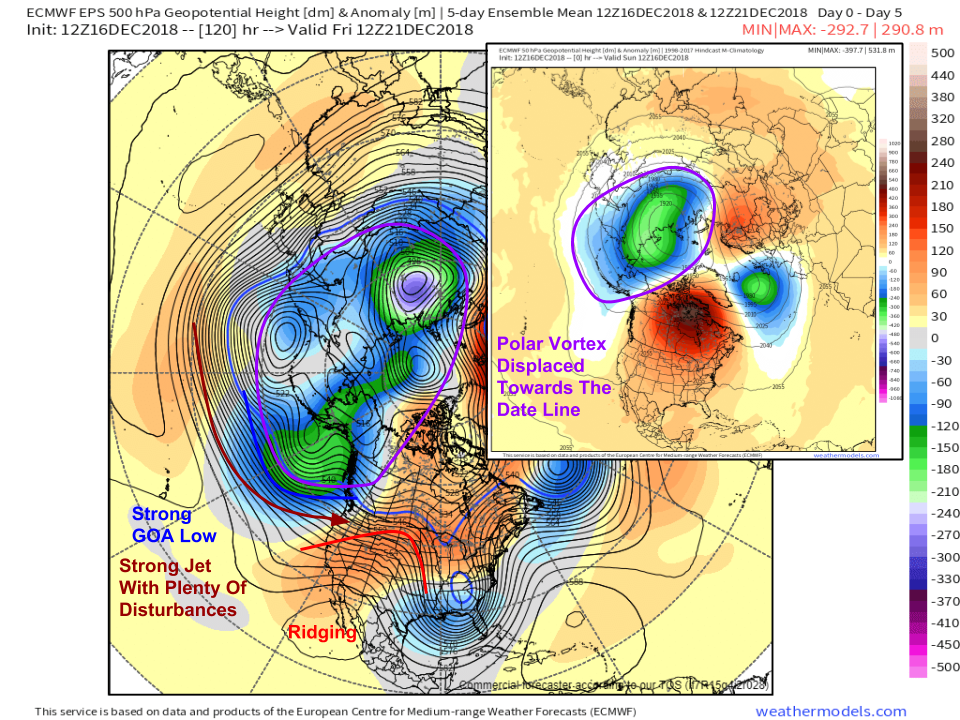
The stratospheric polar vortex has been displaced out towards the International Date Line, including far eastern Siberia and Alaska. The vortex will manifest itself in the lower part of the atmosphere as a series of low pressure systems, one of which will be anchored in the Gulf of Alaska. The jet stream on the southern edge of this low pressure system will send a parade of disturbances towards the West Coast. As they arrive, they’ll be able to tap both tropical moisture and cold air as both are forced together by ridging downstream over the Central Rockies. The result will be a series of rapidly intensifying systems moving towards British Columbia. The southeastern side of these systems will bring the strong winds and heavy precipitation to the Pacific Northwest.
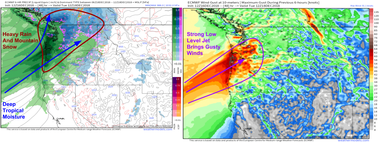
After the current storm wraps up, our attention will turn to the next system due to arrive on Tuesday. ECMWF forecasts via weathermodels.com show a strong low-level jet bringing strong winds to parts of SW WA and NW OR. Many places will gust over 50mph, especially exposed higher elevation coastal locations. This LLJ will transport deep tropical moisture into the area, with heavy rain and mountain snow falling as a result. Snow levels will hover between 4 and 6 thousand feet for Tuesday’s storm.
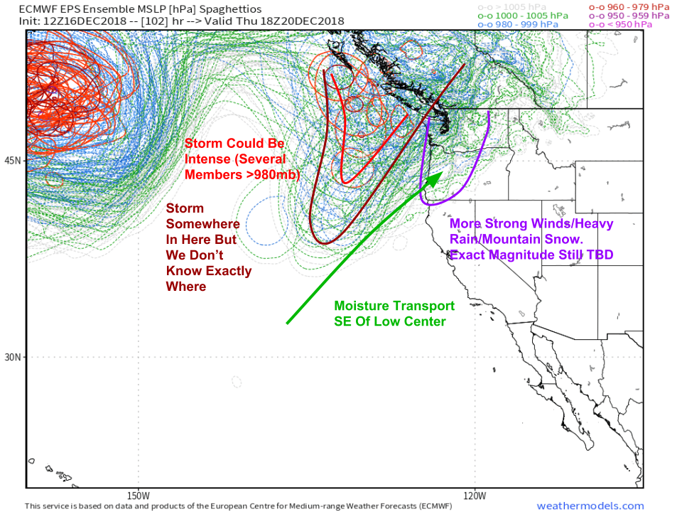
There’s a bit more uncertainty regarding the next storm, set to arrive on Thursday. Ensemble forecasts indicate high confidence in some sort of system off the WA/OR coast on Thursday, but its exact placement and intensity have yet to be determined. Several members have the central pressure of the storm below 980mb, so it could be quite strong. Regardless of its exact placement, moisture will once again be funneled north on its southeastern side, with more rain, snow, and high winds occurring as a result. The uncertainty primarily revolves around just how intense each of those elements might be, with of course a stronger storm being more impactful. Snow levels will likely be a bit higher for this storm, around 5-7 thousand feet.
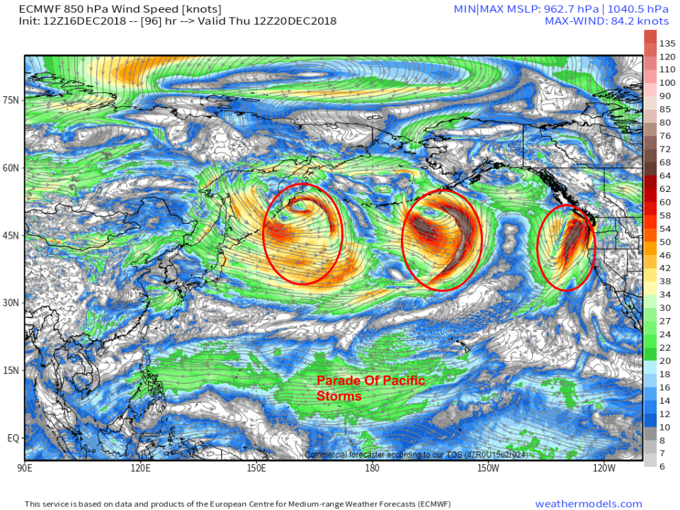
After Thursday, the pattern shows little sign of letting up with a parade of storms noted from North America all the way across the Pacific to Kamchatka. As these churn east, they’ll break up and reform into new storms, continuing the active pattern for the PNW.
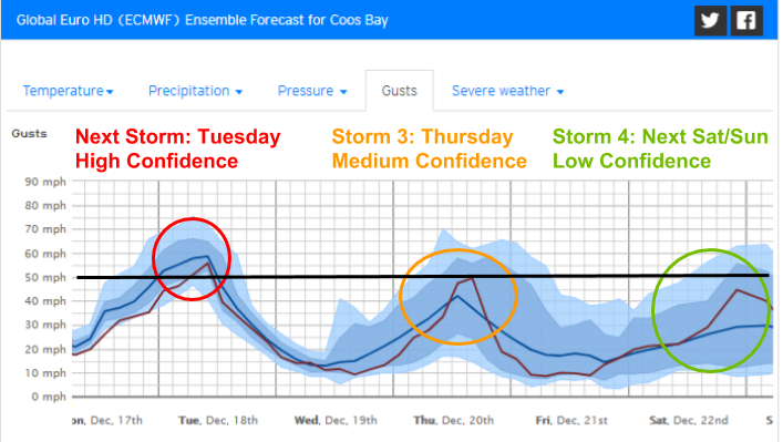
Ensemble forecasts for individual locations on the Oregon Coast highlight the next few storms well, as well as the gradually decreasing forecast confidence as you head through time. The first storm is very likely to bring guests over 50-60 mph on Tuesday. Thursday’s storm could perform similarly if it’s strong enough, but may also be a bit weaker in the 40-50mph range. The storm after that, arriving about a week from now, will also likely be gusty, but the widespread in ensemble outputs signals low forecast confidence by then. Just type your town’s name into the search box on our homepage, and select “Forecast Ensemble” from the menu bar at the left of your screen.
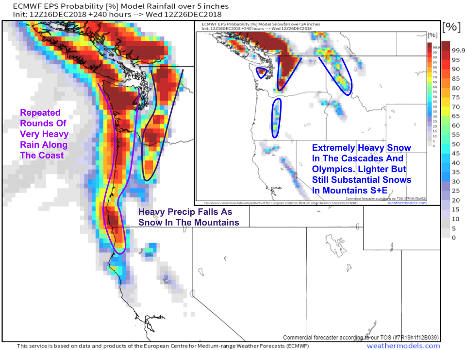
By the time all is said and done around 10-14 days from now, plenty of moisture will have fallen in various forms across Washington and Oregon. The big map shows the probability of more than 5″ of liquid (either rain or melted snow) falling over the next 10 days, while the smaller map shows the probability of more than two feet of snow accumulating during the same time. Of course, the snow map assumes a 10:1 snow: liquid ratio, so amounts will be higher especially in Idaho/Montana where colder air will be present. While the coming stretch will be dreary and may bring some flooding threats, patterns like this help to ensure healthy water supplies for the summer dry season!