


BULLETIN
Hurricane Florence Intermediate Advisory Number 54A NWS National Hurricane Center Miami FL AL062018 800 PM EDT Wed Sep 12 2018
…FLORENCE WEAKENS SLIGHTLY AS IT CONTINUES TOWARD THE CAROLINA COASTAL AREAS…
…LIFE-THREATENING STORM SURGE AND RAINFALL EXPECTED… SUMMARY OF 800 PM EDT…0000 UTC…
INFORMATION –LOCATION…31.5N 73.2W ABOUT 335 MI…540 KM SE OF WILMINGTON NORTH CAROLINA ABOUT 370 MI…595 KM ESE OF MYRTLE BEACH SOUTH CAROLINA MAXIMUM SUSTAINED WINDS…115 MPH…185 KM/H PRESENT MOVEMENT…NW OR 315 DEGREES AT 16 MPH…26 KM/H MINIMUM CENTRAL PRESSURE…956 MB…28.23 INCHES
8:00pm advisory continued

WATCHES AND WARNINGS —-CHANGES WITH THIS ADVISORY: None.
SUMMARY OF WATCHES AND WARNINGS IN EFFECT: A Storm Surge Warning is in effect for… * South Santee River South Carolina to Duck North Carolina * Albemarle and Pamlico Sounds, including the Neuse and Pamlico Rivers A Storm Surge Watch is in effect for… * Edisto Beach South Carolina to South Santee River South Carolina * North of Duck North Carolina to the North Carolina/Virginia border A Hurricane Warning is in effect for… * South Santee River South Carolina to Duck North Carolina * Albemarle and Pamlico Sounds A Hurricane Watch is in effect for… * Edisto Beach South Carolina to South Santee River South Carolina A Tropical Storm Warning is in effect for… * North of Duck North Carolina to the North Carolina/Virginia border A Tropical Storm Watch is in effect for… * North of the North Carolina/Virginia border to Cape Charles Light Virginia * Chesapeake Bay south of New Point Comfort Interests elsewhere in the southeastern and mid-Atlantic states should monitor the progress of Florence. A Storm Surge Warning means there is a danger of life-threatening inundation, from rising water moving inland from the coastline, during the next 36 hours in the indicated locations. For a depiction of areas at risk, please see the National Weather Service Storm Surge Watch/Warning Graphic, available at hurricanes.gov. This is a life-threatening situation. Persons located within these areas should take all necessary actions to protect life and property from rising water and the potential for other dangerous conditions. Promptly follow evacuation and other instructions from local officials. A Storm Surge Watch means there is a possibility of life- threatening inundation, from rising water moving inland from the coastline, in the indicated locations during the next 48 hours.
A Hurricane Warning means that hurricane conditions are expected somewhere within the warning area. A warning is typically issued 36 hours before the anticipated first occurrence of tropical-storm- force winds, conditions that make outside preparations difficult or dangerous. Preparations to protect life and property should be rushed to completion.
MODELS
ECMWF

CMC-CANADIAN MODEL


DISCUSSION AND OUTLOOK -At 800 PM EDT (0000 UTC), the center of Hurricane Florence was located near latitude 31.5 North, longitude 73.2 West. Florence is moving toward the northwest near 16 mph (26 km/h), and this general motion, accompanied by a gradual decrease in forward speed, is expected to continue through Saturday. On the forecast track, the center of Florence will move over the southwestern Atlantic Ocean between Bermuda and the Bahamas tonight, and approach the coast of North Carolina or South Carolina in the hurricane warning area on Thursday and Friday, and move slowly near the coastline through Saturday. Reports from an Air Force Reserve Hurricane Hunter aircraft indicate that maximum sustained winds have decreased to near 115 mph (185 km/h) with higher gusts.
Florence is a category 3 hurricane on the Saffir-Simpson Hurricane Wind Scale. Some fluctuations in strength are possible through Thursday morning. Although slow weakening is expected to begin by late Thursday, Florence is forecast to be an extremely dangerous major hurricane when it nears the U.S. coast late Thursday and Friday. Hurricane-force winds extend outward up to 70 miles (110 km) from the center and tropical-storm-force winds now extend outward up to 195 miles (315 km). The minimum central pressure extrapolated by the Hurricane Hunter aircraft is 956 mb (28.23 inches).
HAZARDS AFFECTING LAND
SURF: Swells generated by Florence are affecting Bermuda, portions of the U.S. East Coast, and the northwestern and central Bahamas. These swells are likely to cause life-threatening surf and rip current conditions. Please consult products from your local weather office.


8:00pm continued
STORM SURGE: The combination of a dangerous storm surge and the tide will cause normally dry areas near the coast to be flooded by rising waters moving inland from the shoreline. The water has the potential to reach the following heights above ground if peak surge occurs at the time of high tide… Cape Fear NC to Cape Lookout NC, including the Neuse, Pamlico, Pungo, and Bay Rivers…9-13 ft North Myrtle Beach SC to Cape Fear NC…6-9 ft Cape Lookout NC to Ocracoke Inlet NC…6-9 ft South Santee River SC to North Myrtle Beach SC…4-6 ft Ocracoke Inlet NC to Salvo NC…4-6 ft Salvo NC to North Carolina/Virginia Border…2-4 ft Edisto Beach SC to South Santee River SC…2-4 ft The deepest water will occur along the immediate coast in areas of onshore winds, where the surge will be accompanied by large and destructive waves. Surge-related flooding depends on the relative timing of the surge and the tidal cycle, and can vary greatly over short distances. For information specific to your area, please see products issued by your local National Weather Service forecast office.
RAINFALL: Florence is expected to produce heavy and excessive rainfall in the following areas… Coastal North Carolina…20 to 30 inches, isolated 40 inches. This rainfall would produce catastrophic flash flooding and significant river flooding. South Carolina, western and northern North Carolina…5 to 10 inches, isolated 20 inches. Elsewhere in the Appalachians and Mid-Atlantic states…3 to 6 inches, isolated 12 inches.
PROJECTED PRECIP TOTALS
BROKEN DOWN BY STATE-
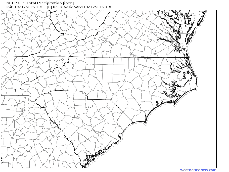
GFS MODEL FOR NORTH CAROLINA
SOUTH CAROLINA

ECMWF MID-ATLANTIC REGION

CMC-CANADIAN


8:00pm WINDS
WIND: Hurricane conditions are expected to reach the coast within the hurricane warning area late Thursday or Friday. Winds are expected to first reach tropical storm strength on Thursday, making outside preparations difficult or dangerous. Preparations to protect life and property should be rushed to completion.


TORNADOES: A few tornadoes are possible in eastern North Carolina beginning late Thursday morning.

Hurricane Florence Discussion Number 54
NWS National Hurricane Center Miami FL AL062018 500 PM EDT Wed Sep 12 2018 Data from an Air Force Reserve hurricane hunter aircraft along with satellite imagery and various intensity estimates indicate that Florence has weakened instead of strengthening. However, while the hurricane hasn’t strengthened in terms of peak winds, the inner-core and outer wind fields have continued to expand, resulting in an increase the cyclone’s total energy, which will create a significant storm surge event. The upper-level outflow remains impressive and is still expanding except toward the south. Florence is moving toward the northwest or 315/14 kt. The new 12Z global and regional model runs have come into much better agreement on Florence moving steadily northwestward around a strong ridge located between Bermuda and the U.S. mid-Atlantic region for the next 48 hours or so. By late on day 2, Florence is forecast to approach the southern portion of the North Carolina coast, then slow down considerably and turn westward within collapsing steering flow, with a very slow westward motion near the coasts of North and South Carolina continuing into Friday and Saturday. Corrected-consensus models HCCA and FSSE remain very close to each other and are quite similar to the simple consensus model TVCA. Therefore, only a slight eastward shift was needed to the previous forecast track through 36 hours or so, mainly due to the more eastward initial position based on the reconnaissance fixes.
At 48 hours and beyond, no significant changes were required to the previous advisory track, which still shows Florence moving slowly westward across South Carolina and western North Carolina on day 4, followed by a slow northward motion up the Appalachian mountain chain on day 5. A narrow window of opportunity remains during the next 24 hours or so for Florence to strengthen a little when the hurricane passes over the warmer SSTs and deeper warm water/higher upper-ocean heat content associated with the Gulf Stream, and low vertical shear conditions of 5-10 kt will aid in any strengthening process. However, significant strengthening is not anticipated due to Florence’s large and expanding inner-core wind field. By 36 h and beyond, decreasing ocean heat content along with the slowing forward speed of Florence will likely produce cold upwelling beneath the hurricane, inducing a gradual weakening trend. When Florence moves over the shallow coastal shelf waters in 48-72 h, land interaction and more significant upwelling are anticipated, which should further enhance the weakening process. The NHC intensity forecast remains near the higher statistical guidance through 48 hours, then follows the trend of the decay SHIPS model after that time. Although the maximum winds are expected to weaken a little more, Florence is still expected to remain a dangerous major hurricane as it approaches the coast. The threat to life from storm surge and rainfall will not diminish, and these impacts will cover a large area regardless of exactly where the center of Florence moves.

Key Messages:
1. A life-threatening storm surge is now highly likely along portions of the coastlines of South Carolina and North Carolina, and a Storm Surge Warning is in effect for a portion of this area. All interests in these areas should complete preparations and follow any advice given by local officials.
2. Life-threatening, catastrophic flash flooding and prolonged significant river flooding are likely over portions of the Carolinas and the southern and central Appalachians late this week into early next week, as Florence is expected to slow down as it approaches the coast and moves inland.
3. Damaging hurricane-force winds are likely along portions of the coasts of South Carolina and North Carolina, and a Hurricane Warning is in effect. Strong winds could also spread inland into portions of the Carolinas.
4. Large swells affecting Bermuda, portions of the U.S. East Coast, and the northwestern and central Bahamas will continue this week, resulting in life-threatening surf and rip currents.
TROPICAL STORM ISAAC


TROPICAL STORM ISAAC 8:00PM
BULLETIN
Tropical Storm Isaac Intermediate Advisory Number 21A NWS National Hurricane Center Miami FL AL092018 800 PM AST Wed Sep 12 2018 …NOAA HURRICANE HUNTER AIRCRAFT CURRENTLY INVESTIGATING ISAAC… SUMMARY OF 800 PM AST…0000 UTC…INFORMATION –LOCATION…15.4N 57.2W ABOUT 260 MI…420 KM ENE OF MARTINIQUE ABOUT 295 MI…470 KM E OF GUADELOUPE MAXIMUM SUSTAINED WINDS…60 MPH…95 KM/H PRESENT MOVEMENT…W OR 275 DEGREES AT 20 MPH…31 KM/H MINIMUM CENTRAL PRESSURE…1003 MB…29.62 INCHES
WATCHES AND WARNINGS –CHANGES WITH THIS ADVISORY: None.
SUMMARY OF WATCHES AND WARNINGS IN EFFECT: A Tropical Storm Warning is in effect for… * Martinique * Dominica * Guadeloupe A Tropical Storm Watch is in effect for… * Antigua * Montserrat * St. Kitts and Nevis * Saba and St. Eustatius * St. Martin and St. Maarten A Tropical Storm Warning means that tropical storm conditions are expected somewhere within the warning area, in this case within 24 hours. A Tropical Storm Watch means that tropical storm conditions are possible within the watch area, in this case within 24 hours. Interests elsewhere in the Leeward Islands should monitor the progress of Isaac. For storm information specific to your area, please monitor products issued by your national meteorological service.


ISAAC 8PM CONTINUED
DISCUSSION AND OUTLOOK –At 800 PM AST (0000 UTC), the center of Tropical Storm Isaac was located near latitude 15.4 North, longitude 57.2 West. Isaac is moving toward the west near 20 mph (31 km/h), and this general motion with a decrease in forward is expected to continue through the weekend. On the forecast track, Isaac is forecast to move across the central Lesser Antilles and into the eastern Caribbean Sea on Thursday, and then move across the eastern and central Caribbean Sea through Saturday. Maximum sustained winds are near 60 mph (95 km/h) with higher gusts. Some weakening is forecast during the next 48 hours. Tropical-storm-force winds extend outward up to 175 miles (280 km) from the center. The estimated minimum central pressure is 1003 mb (29.62 inches).
HAZARDS AFFECTING LAND –RAINFALL: Isaac is expected to produce total rainfall accumulations of 2 to 4 inches with isolated amounts up to 8 inches across Martinique, Dominica, and Guadeloupe. Rainfall of 1 to 2 inches with isolated amounts to 4 inches are forecast across Puerto Rico and the southern United States Virgin Islands, with up to an inch anticipated across the remaining Windward and Leeward Islands. This rainfall may cause life-threatening flash flooding. WIND: Tropical storm conditions are expected on Martinique, Dominica, and Guadeloupe early Thursday. Tropical storm conditions are possible within the tropical storm watch area on Thursday.
STORM SURGE: Some coastal flooding is possible in areas of onshore winds. Near the coast, the surge will be accompanied by large waves.
SURF: Swells generated by Isaac are affecting portions of the Lesser Antilles. These swells are likely to cause life-threatening surf and rip current conditions. Please consult products from your local weather office.


STORM SURGE: Some coastal flooding is possible in areas of onshore winds. Near the coast, the surge will be accompanied by large waves. SURF: Swells generated by Isaac are affecting portions of the Lesser Antilles. These swells are likely to cause life-threatening surf and rip current conditions. Please consult products from your local weather office.
Tropical Storm Isaac Discussion Number 21
NWS National Hurricane Center Miami FL AL092018 500 PM AST Wed Sep 12 2018 The satellite presentation of Isaac hasn’t changed much in the past several hours, with the center exposed on the west side of a re-developing band of convection. On the last pass of the NOAA Hurricane Hunter aircraft, peak flight-level winds were 61 kt and SFMR values were about 50 kt. These data support an initial wind speed estimate of 50 kt. It is interesting to note that the surface center is estimated to be a tenth of a degree or two south of the well-defined swirl on satellite–a function of the fast forward speed and high shear. The shear is forecast to continue for the next day or two, and gradual weakening is anticipated, in line with the model guidance. Given the strong shear, it is possible that Isaac could degenerate into a wave near the Lesser Antilles. After that time, Isaac could escape the upper-level trough over the central Atlantic that has been shearing the cyclone, and find a more conducive environment. More of the model guidance is suggesting some reintensification of the cyclone in the western Caribbean Sea, with the biggest hold-out being the ECMWF.
Continuity dictates that the forecast not change as much as the guidance, most of which is showing a hurricane at long range, so the compromise solution is no longer dissipating the cyclone and flat-lining the intensity at long range. It almost goes without saying that this is a low-confidence intensity forecast. Isaac has accelerated to near 17 kt over the past 12 hours, and the shorter-term motion is closer to 20 kt with the convection-less center. A mid-tropospheric high is forecast to persist for the next several days, which should keep the cyclone moving westward, albeit at a slightly slower pace. The model guidance has shifted a bit to the north on this cycle, but is mostly in response to the initial latitude. The NHC track forecast is moved northward as well but still lies on the south side of the consensus. At long range, it makes sense when forecasting a weaker system to stay on the left and faster side of the consensus, so that’s where the new NHC prediction lies.

Key Messages:
1. Isaac is expected to remain at tropical storm intensity when it moves across the Lesser Antilles on Thursday, and tropical storm warnings are in effect for Martinique, Dominica, and Guadeloupe. Tropical storm watches are in effect for Montserrat, St. Kitts and Nevis, Antigua, and Saba and St. Eustatius. Interests on those islands should follow any advice given by their local officials.
2. Life-threatening flash flooding is possible with Isaac. The storm is expected to produce total rainfall accumulations of 2 to 4 inches with isolated amounts up 8 inches across Martinique, Dominica and Guadeloupe. Rainfall amounts of 1 to 2 inches with isolated amounts to 4 inches are expected across Puerto Rico and the southern United States Virgin Islands.
Tropical Weather Outlook
NWS National Hurricane Center Miami FL 800 PM EDT Wed Sep 12 2018 For the North Atlantic…Caribbean Sea and the Gulf of Mexico: The National Hurricane Center is issuing advisories on Hurricane Florence, located over the western Atlantic Ocean, on Hurricane Helene, located over the eastern Atlantic Ocean, on Tropical Storm Isaac, located a few hundred miles east of the Lesser Antilles, and on newly formed Subtropical Storm Joyce, located several hundred miles west-southwest of the Azores.
1. A broad area of low pressure is located over the central Gulf of Mexico. Although the shower activity is still disorganized, upper-level winds are forecast to become more conducive for development, and it is likely that a tropical depression will form Thursday or Thursday night, before the system reaches the western Gulf coast. An Air Force Reserve Hurricane Hunter aircraft is scheduled to investigate the disturbance tomorrow, if necessary. Regardless of development, heavy rainfall and gusty winds are expected across portions of northeastern Mexico, Texas, and Louisiana late this week. Interests there should monitor the progress of this system, and refer to products from their local weather office.
* Formation chance through 48 hours…high…70 percent.
* Formation chance through 5 days…high…70 percent.
2. An area of low pressure is expected to develop near Bermuda late this weekend or early next week. Some gradual development is possible after that time while the system drifts westward over the western Atlantic.
* Formation chance through 48 hours…low…near 0 percent.
* Formation chance through 5 days…low…20 percent.


1. Satellite images and surface observations indicate that a broad area of low pressure has formed in the central Gulf of Mexico. Although the shower activity is still disorganized, upper-level winds are forecast to become more conducive for development, and it is likely that a tropical depression will form on Thursday, before the system reaches the western Gulf coast. Another reconnaissance plane is scheduled to investigate the disturbance tomorrow. Regardless of development, heavy rainfall and gusty winds are expected across portions of northeastern Mexico, Texas, and Louisiana late this week, and interests there should monitor the progress of this system, and refer to products from their local weather office.
* Formation chance through 48 hours…high…70 percent.
* Formation chance through 5 days…high…70 percent.