
The cold is coming, See the paint bomb on the 15 day ensemble EPS.
.png)
That usually means trouble around the edges. In today’s regional update we looked at the last 4 runs of the GFS for the south central – each very different and with one at 00Z off the charts for ice.
.jpg)
I looked then at the southeast where the recent snowstorm left Atlanta suburbs in shock and in the dark. It too saw different ideas with snow and/or ice.
.jpg)
The northeast we have shown was going to see warm air push north this weekend ahead of the cold. The model has been gradually shifted towards colder sooner and more ice and snow.
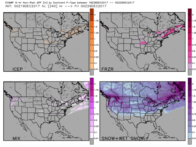
.jpg)
For the next 10 days, the op run EC sees the icing in southern Missouri in one of the GFS runs and ice and some snow northeast. Ice is not uncommon in La Nina Decembers in the northeast, No one wants to sit in the dark on Christmas (or ever for that matter when it is cold) though.
Bottom line is to stay tuned and plan accordingly.