Michael is currently centered about 360 miles south of Panama City, Florida, and is moving north.
(LATEST NEWS: Evacuations Ordered Along Florida Coast)

A storm surge warning is in effect from the Okaloosa/Walton County line in Florida to Anclote River, Florida. This means life-threatening storm surge inundation is a danger in the warning area within 36 hours.
Storm surge watches are in effect from Anclote River, Florida, to Anna Maria Island, Florida, including Tampa Bay, and from the Alabama/Florida border to the Okaloosa/Walton County line in Florida. This means life-threatening storm surge inundation is possible in the watch area within 48 hours.

A hurricane warning is posted for the Florida Gulf coast from the Alabama/Florida border to Suwanee River, Florida, including Pensacola, Panama City and Tallahassee. The hurricane warning also extends inland to southwestern Georgia, including Albany. Hurricane warnings are issued 36 hours before the anticipated arrival of tropical-storm-force winds (39-plus mph), which is when outside preparations become dangerous.
Tropical storm warnings are in effect from the Alabama/Florida border westward to the Mississippi/Alabama border and from Suwannee River, Florida, southward to Chassahowitzka, Florida. The tropical storm warning also extends inland to portions of southern Alabama and southwestern Georgia, including Mobile, Alabama, and Valdosta, Georgia. This means tropical storm conditions are expected somewhere within the warning area within 36 hours.
Tropical storm watches have been posted from Chassahowitzka, Florida, to Anna Maria Island, Florida, including Tampa Bay, from the Mississippi/Alabama border westward to the mouth of the Pearl River, and along parts of the Southeast coast from north of Jacksonville to near Charleston, South Carolina, including Savannah and Bruswick/St. Simons Island, Georgia. This means tropical storm-force conditions are possible within 48 hours.

Interests along the northeastern Gulf Coast in the path of Michael should be rushing preparations to completion. Follow the advice of local officials if you are ordered to evacuate, particularly if you live in a storm-surge-prone location.
Forecast
Timing
– Landfall is most likely to occur somewhere between the Florida Panhandle and the Big Bend of Florida a few hours either side of midday Wednesday.
– Conditions will begin to deteriorate as early as Tuesday evening on the northeastern Gulf Coast.
– After landfall, Michael will then accelerate inland across the southeastern U.S. Wednesday night through Thursday night with gusty winds and heavy rain.
– Michael could enhance rainfall in the mid-Atlantic and southeastern New England Thursday night and Friday.

Intensity
-The NHC is forecasting Michael to be at least a Category 3 hurricane when it approaches the Florida Panhandle Wednesday.
– There remains some uncertainty in the intensity forecast, and Michael could be slightly weaker or stronger near landfall.
– Michael will still be a dangerous hurricane even if it does not intensify as much as currently forecast.
Wind
– Hurricane-force winds (74-plus mph) are expected to arrive in the hurricane warning area on the Florida Gulf coast Wednesday and are possible in the hurricane watch area on the northeastern Gulf Coast by that time.
– Tropical-storm-force winds (39-plus mph) are expected to arrive in the hurricane warning area on the Florida Gulf coast by Tuesday night or early Wednesday.
– Tropical-storm-force winds are most likely to arrive in the tropical storm warning area on the northeastern Gulf Coast by Tuesday night or early Wednesday and are possible in the tropical storm watch area by that time.

– Widespread power outages, major tree damage and structural damage will occur along the path of Michael near and just inland from where it makes landfall on the Florida Panhandle.
– Widespread power outages may extend into parts of south Georgia and far southeast Alabama, given Michael’s faster movement.
– Winds capable of power outages and at least some tree damage may extend into parts of north Georgia and the Carolinas, as well. This is a particular concern in areas where soil is still saturated from Florence’s torrential rain in the northeast South Carolina and North Carolina.
– One forecast model from the University of Michigan suggests there could be at least 2 million customers without power from Michael, from Florida to southeast Virginia.
– Metro areas that may experience power outages include: Tallahassee, Atlanta, Jacksonville, Columbia, Greenville-Spartanburg, Charleston, Charlotte and Raleigh-Durham.

Storm Surge
Life-threatening storm surge flooding will occur along the immediate coastline near and east of where the center makes landfall. Michael is expected to affect portions of the Florida Gulf coast that are especially vulnerable to storm surge, particularly Apalachee Bay south of Tallahassee.
The NHC says water levels on the Gulf Coast could reach the following heights if the peak storm surge arrives at high tide:
– Indian Pass to Cedar Key, Florida: 8 to 12 feet
– Cedar Key to Crystal River, Florida: 6 to 8 feet
– Okaloosa/Walton County line to Indian Pass, Florida: 6 to 9 feet
– Crystal River to Aripeka, Florida: 4 to 6 feet
– Aripeka to Anna Maria Island, including Tampa Bay, Florida: 2 to 4 ft
– Alabama/Florida border to Okaloosa/Walton County Line, Florida: 2 to 4 feet
)

Here are the high tides of concern through early Thursday for a few locations in the storm surge threat area along the Florida Gulf coast (all times are local):
– Panama City: 10:57 p.m. Tuesday | 10:30 p.m. Wednesday
– Apalachicola: 5:16 p.m. Tuesday | 4:39 a.m. and 6:10 p.m. Wednesday | 4:58 a.m. Thursday
– Cedar Key: 2:52 p.m. Tuesday | 2:48 a.m. and 3:36 p.m. Wednesday | 3:18 a.m. Thursday
– Tampa Bay/St. Petersburg: 3:17 p.m. Tuesday | 2:46 a.m. and 4:06 p.m. Wednesday | 3:09 a.m. Thursday
On the southeastern U.S. coast, onshore winds and high astronomical tides will also lead to some coastal flooding this week.
Charleston Harbor is forecast to see minor to moderate coastal flooding at high tide.
Some coastal flooding will also occur as far west as the Texas coast, as was noted Monday on the Bolivar Peninsula and at S. Padre Island.
Rainfall
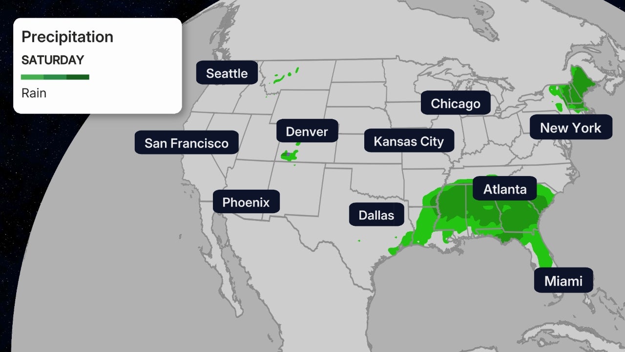
– Rainfall totals of 4 to 8 inches are forecast from the Florida Panhandle and Big Bend into southeastern Alabama and south Georgia, according to the NHC. Locally up to a foot of rain is possible. This may cause life-threatening flash flooding in some areas.
– Eastern Georgia, the Carolinas and southern Virginia may pick up 3 to 6 inches of rain, potentially triggering flash flooding. This will include some areas devastated by flooding from Hurricane Florence. That said, this system will move quickly, rather than stall like Florence did and will, therefore, not bring extreme rainfall amounts.
– The Florida Peninsula, eastern mid-Atlantic and southern New England coast may see 1 to 3 inches of rain.

Tornadoes
– As is typical with landfalling hurricanes, isolated tornadoes will be a threat on the eastern side of the storm.
– A tornado threat may develop in the Florida Panhandle and southern Georgia by Wednesday.
Check back with weather.com throughout the week ahead for more details on the forecast for Michael.
Cuba Impact
Tropical storm warnings have been dropped in Cuba.
However, trailing bands of rain on the southeastern flank of Michael continue over western Cuba.
Rainfall totals of 4 to 8 inches (locally 12 inches) are forecast over western Cuba.
These downpours could contribute to life-threatening flash flooding and mudslides, particularly in areas of mountainous terrain.
Storm History
Outer rainbands from Michael already soaked the Florida Keys Monday. A wind gust to 55 mphwas measured at the NWS office in Key West, Florida, late Monday afternoon in association with Hurricane Michael’s outer rainbands.
Michael rapidly intensified from 11 a.m. EDT Sunday to 11 a.m. EDT Monday, when its winds increased from 35 mph to 75 mph during that 24-hour period.

