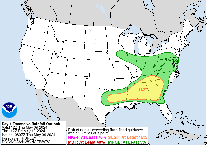
Tonight through Sunday…
An upper level low pressure trough will be over Texas for the next few days, which will enhance the rain chances for our area. Some scattered showers and storms will be possible tonight, as a result. Southerly surface winds will help to enhance the moisture and warm air advection to the area. Upper-level divergence, mainly during peak daytime heating hours tonight and over the next few days, will help to enhance the lifting and buoyancy in the environment. The PW values Saturday and Sunday were above 1.8, which is around the 90th percentile in the SPC-sounding climatology for these days. During peak daytime heating hours, the PW values are forecast to be above 2.0, which is approaching the max daily values for the SPC-sounding climatology. The mixed layer CAPE is expected to be around 1000 J/kg inside showers and storm development, particularly along the south shore areas, would be enough to fuel instability for convective development. One limiting factor for rainfall development would be the faster winds (corfidi upshear/downshear values are 14kts and 28kts), but we have had numerous rainfall events over the last few months with very similar wind speeds/patterns.

Overall, given the instability, abundant moisture, lifting, and divergence in the environment, there will definitely be the risk of heavy rainfall over the next few days across our area, especially during the afternoon and early evening hours. Rainfall amounts of 2 to 4 inches will be possible with locally higher amounts definitely a possibility inside thunderstorm/shower development. Efficient rainfall will be possible with these showers and storms that will develop, thanks to the upper level divergence. This conducive rainfall environment has been proven today via the storms we have been receiving across the area that have produced high rainfall rates already. Rainfall rates will continue to be fairly high, and some storms could produce rainfall rates in excess of 2 inches/hour tomorrow and Sunday. Consequently, a Flash Flood Watch has been issued from Saturday morning through Sunday evening for most of Southeast Louisiana. The Flash Flood Watch may be expanded in area north and/or eastward, but we wanted to wait for better confidence and consensus in the short-term models. Lightning and gusty winds will also be a threat, particularly during the afternoon hours over the next few days. Waterspouts are also going to be possible over the marine waters as a hazard over the next few days.


