It is another frigid morning int the Great Lakes and Northeast states.
.png)
.png)
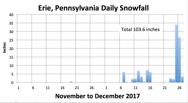
As we showed in the region update, Lake Effect has really kicked in with a record snow blitz in Erie PA with well over 5 feet os snow since just before Christmas.
See the cold the next 5 days.
.png)
The following 5 days is also frigid.
.png)
There may be a storm late next week. The GFS keeps it out to sea.
.png)
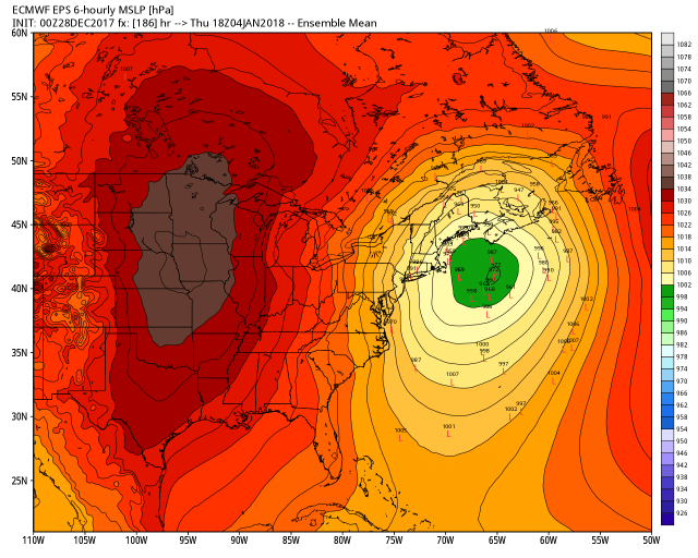
The GEM has the low out to sea but a reflection of the deep upper trough near the coast bring heavy snows to the coastal metros.
.png)
The EC actually develops a slight negative tilt to the trough and though it has the deepest low offshore has the coastal low drive inland.
.png)
.png)
.png)
This delivers heavy snows to NYC and inland New England but has a notch of nothing where a shot of warm air with the inland low comes.
.png)
The EPS ensembles favor the offshore low and fill in the notch with snow. My MS thesis suggested in situations where cold air has pushed offshore, the potential energy explosively deepens the low when the lid on convection in the preceding high pressure is released. The offshore secondary takes control. It takes strong dynamics with a negative tilt to overcome that. I would expect the next run to adjust offshore.
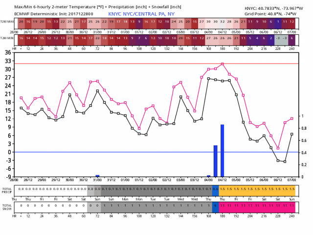
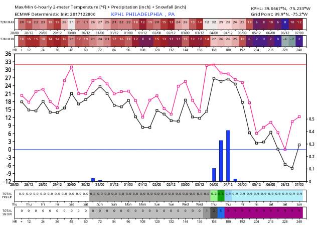
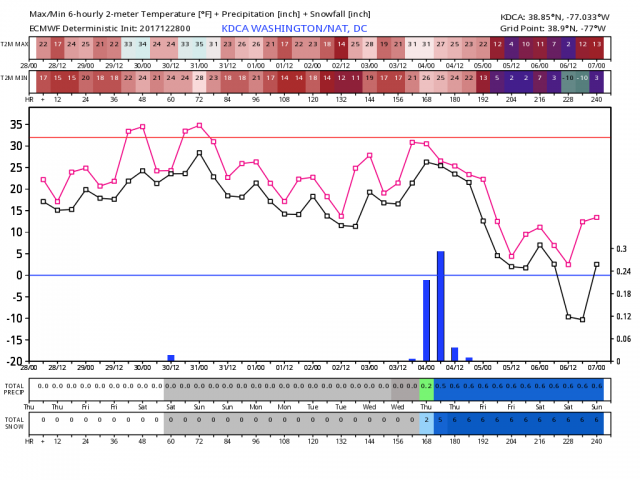
After the storm with a deeper snowcover brutal cold deepens further.
.png)
See how many sub zero lows occurs in the model in Chicago and Detroit.
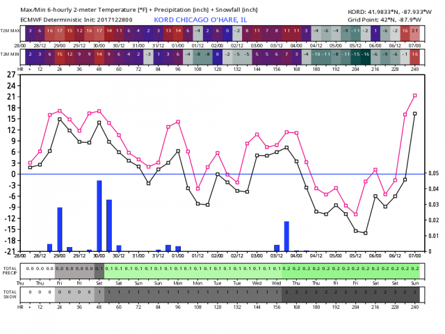
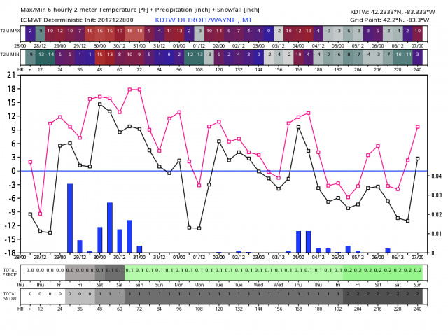
After the snow, the model even has below zero in NYC, PHL and DCA. Regardless it is darn cold.