
7:45 PM EDT Monday 10/8:
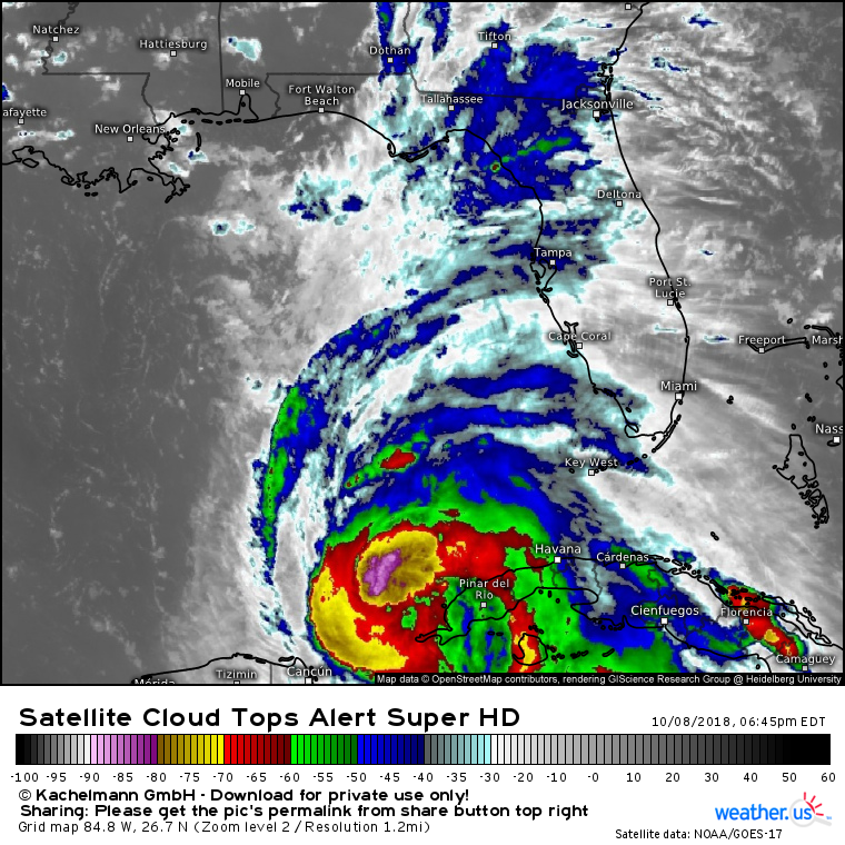
Satellite imagery this evening shows Michael continuing to develop, while also struggling with some dry air. The CDO present over the system’s center earlier this evening has eroded, with dry air working into the system’s southern side. However, intense “hot towers” continue to wrap around the center, as upper level outflow expands to the north. While the storm remains on the uptick, this dry air will slow the rate of intensification a bit in the near term. That does not change the forecast for the Florida though! Michael will still be an extremely dangerous major hurricane as it makes landfall on Wednesday.
12 PM EDT Monday 10/8:
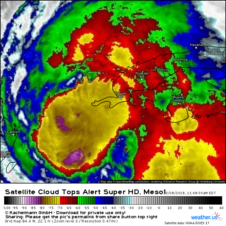
Satellite imagery shortly before noon eastern time shows Michael having successfully built what’s known as a Central Dense Overcast, or CDO for short. This is basically an area of consistently strong thunderstorm activity around the center. If you look closely, you can see the beginnings of an eye/eyewall about half way between Cancun and Manuel Lazo. The storm is moving slowly to the north, and no changes to the going forecast are noted.
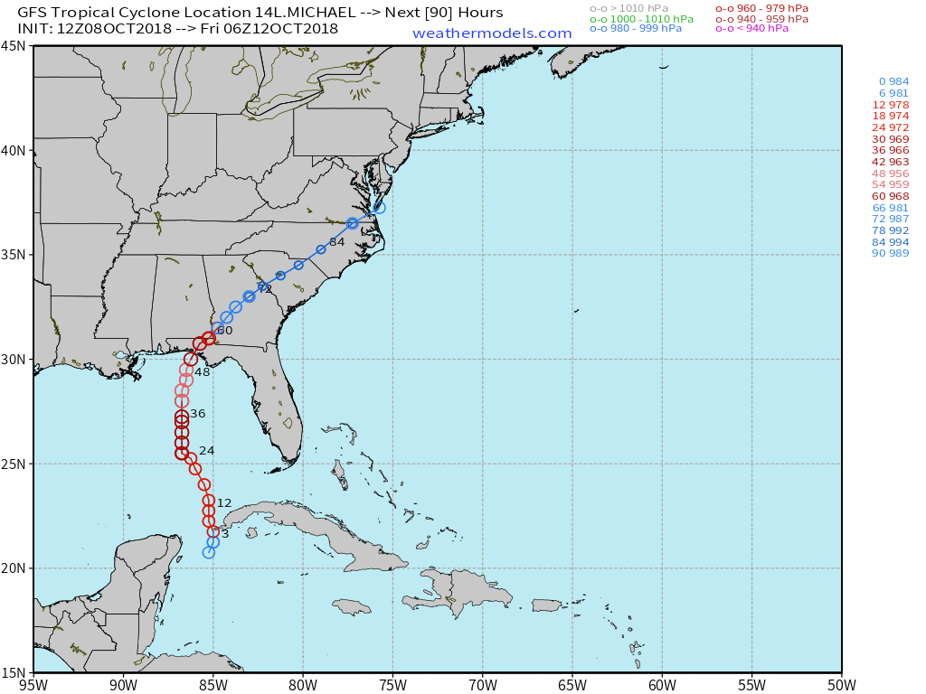
The very latest run of the American GFS model has arrived, and continues to show Michael approaching the Florida Panhandle as a strong hurricane on Wednesday before moving NE through Georgia and the Carolinas Thursday-Friday. The newest ECMWF data will begin arriving around 1:45, with live tracking available at the Weathermodels.com Lab.