
I like the storm next week, The models have a problem that most likely will affect the US model more in that the real storm will be the second piece of energy that comes down, This is NOT A TRANSFER TO THE COAST STORM, It is a storm moving through the lakes dying with a front coming out and that will be the track from the storm, Snow that comes through the midwest Sunday into Monday is not the start its what sarts behind the front in the southern plains and may even get the gulf coast again, which would be the 3rd time this winter it would have snowed to the gulf coast
But this will be a pocket of cold getting caught in a developing ridge position, Has happened before, In 1961 ( here we go the old geezer is pulling out maps from the only thing left in his head, weather) we had an end of a 2 month pattern of cold with a storm, but with precious little negative DN, A wandering cold pool
.gif)
The Lindsey storm in 1969
.gif)
I was using that in 2013 for the monster that hit New england
.gif)
In 1978, the 3rd of the 3 storms in mid Jan was surrounded by ridges, with a subtropical storm north of Puerto Rico to boot
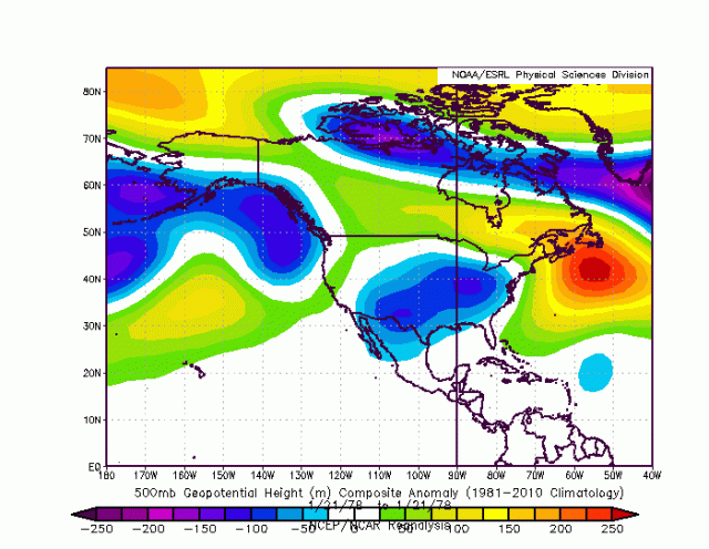
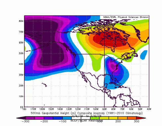
and then there is Feb 78 which dove south out of the Arctic and was a pocket of cold that got caught under the ridge
The GFS will likely have the boundary too far east and also try to put too much into the front-running shortwave through the lakes, Its tricky, but suffice it to say those in a thaw now may have a pretty good amount of snow on the ground next week at this time before a stretch of weather where I cant allude to comebacks a few days after the snow melts takes over