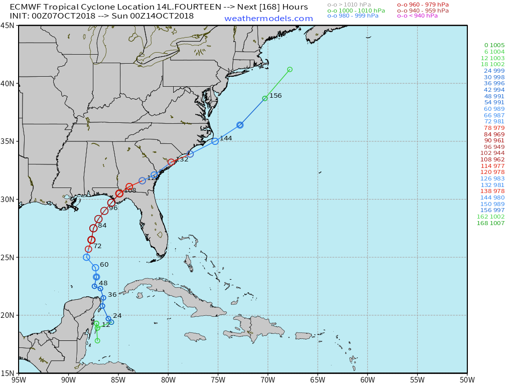
Overnight weather models (GFS, ECMWF/EPS, UKMET) all indicated a powerful hurricane in the Gulf of Mexico this week. The next name on the list is Michael. The National Hurricane Center has initiated advisories on Tropical Depression 14L and does have a 70-knot Category 1 hurricane making landfall (11 AM Sunday discussion) along the Florida Gulf Coast near Panama City.
ECMWF guidance has a 944 mb Central Pressure prior to landfall which would be a major hurricane. Note from the single track ECMWF chart the rapid development over the warm waters of the central Gulf of Mexico from hours 60-84 (starting Tuesday).
The main negative for stronger hurricanes in the Gulf especially in October is deleterious vertical wind shear. With the seasonal change into autumn, upper-level winds e.g. jet stream are much stronger than mid-summer and can tip over or shear apart developing storms. However, the wind shear is expected to abate and instead provide an exhaust mechanism aloft to enhance the intensification of the storm.
Sea-surface temperatures are still very warm in the Gulf well in excess of 29C sufficient for any category of hurricane.
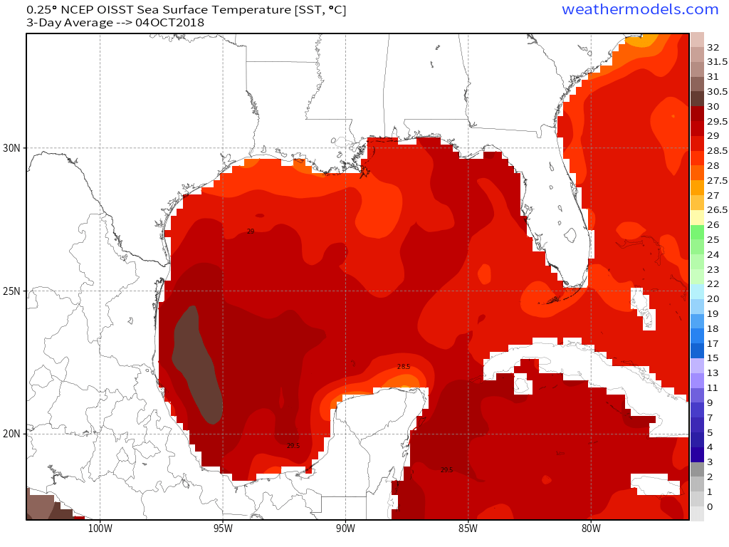
Sea-surface temperatures (SST)
Based upon the model trends, location and time of year, Hurricane Opal from 1995 immediately comes to mind. Over the next 24-48 hours, we will have a better idea about the intensity at landfall primarily based upon the ability of “Michael” to rapidly develop initially.
Real-time satellite imagery from the newest GOES satellites is available: Daytime visible 3-hour LOOP … and nighttime Infrared LOOP.