
The month has averaged in the first 3 weeks well below normal at levels not observed in some places in the record.
.png)
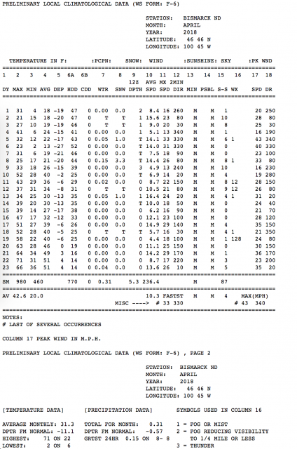
See how persistent the cold was for the first 19 days of the month in Bismarck. The monthly departure even after a handful of above normal days is -11.1F.
As we transition to May, the forecast is for the welcome moderation to continue in the north-central while it remains cooler than normal to the south.
.png)
The warmth comes in waves as storms come out of the west. Cooler conditions follow them.
.png)
The 6 week suggest it is perhaps a brief incursion with it mostly cool east of the continental divide.
.png)
The last 90 days have been wetter/snowier north but drier in the central and southern high plains though wetter east.
.png)
That is reflected in the soil moisture anomalies.
.gif)
Most of the change since January 31st has been the turn wetter in the eastern areas of the central.
.gif)
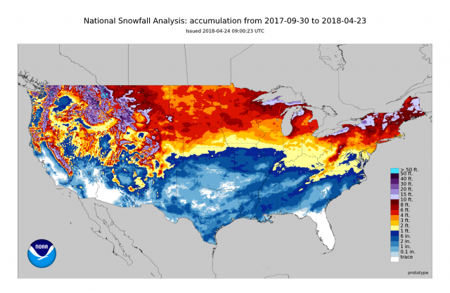
Snow has been abundant in much of the nation, biased heavy of course north.
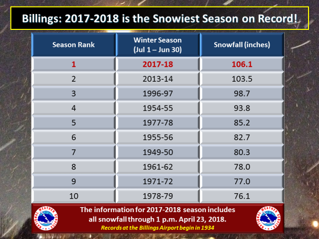
Billings had their snowiest winter on record beating out 2013/14.
The next 15 day and 46-day forecasts show a welcome drying to enable the soil to dry out for fieldwork and planting.
.png)
.png)
The CAS and Pioneer model summer outlook suggest the region should be normal with the warmer west and cooler conditions east but the northwestern areas may be dry and see some periodic heat, See the effect of the summer monsoon and perhaps tropical action south.
.png)