A dangerously cold and massive arctic air mass dominates tNorth America east of the Continental Divide.
.png)
Anomalies are almost off the scale as people prepare for New Year’s festivities.
.png)
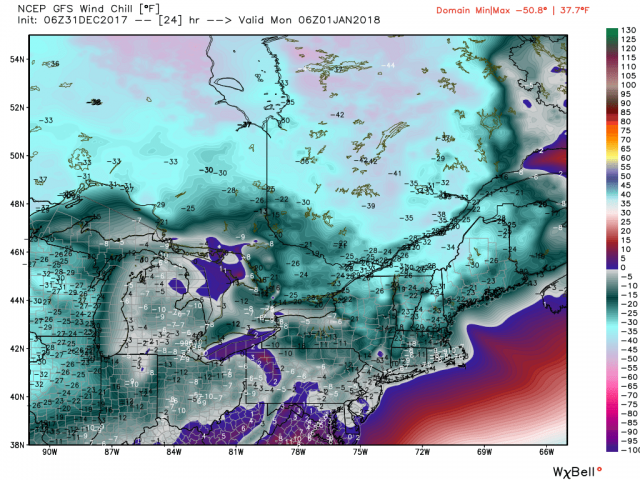
Temperatures will be below zero across the north and wind chills well below zero for almost half of the nation.
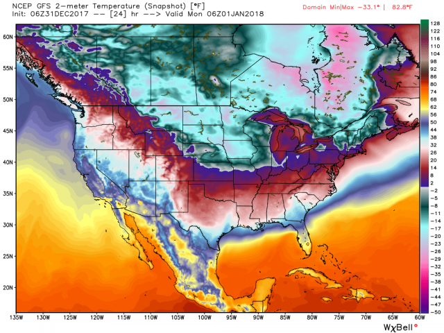
.png)
Many parts of the midwest will have wind chills near of below -40F.
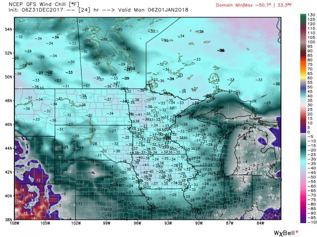
The cold extends well into the south.
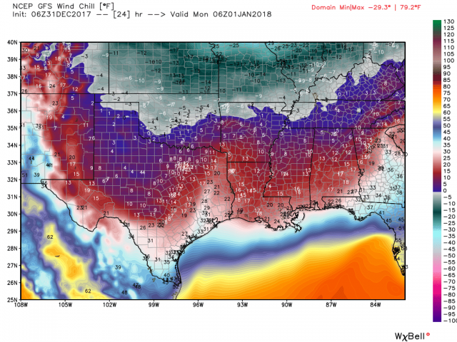
The northeast temperatures will range from single numbers to well below zero at midnight.
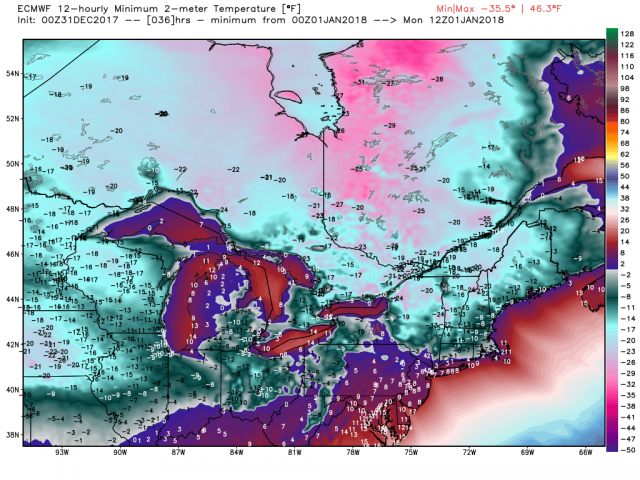
Temperatures could be in the high single digits at Times Square as the ball drops, In case you are wondering the coldest in the city was 2F in 1962, one of our analogs. Wind chills will be at dangerous levels below the zero mark.
The double barrel storm for Thursday modeled earlier this week is back in the models as often happens. The EC and GEM have the most impact.
.png)
.png)
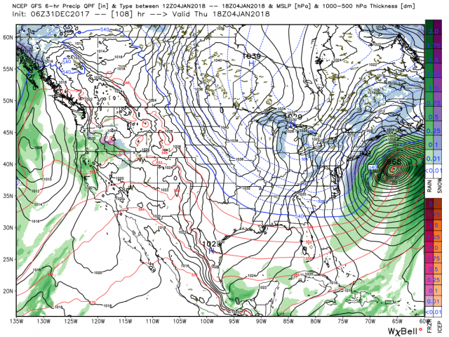
The EC follows it with a clipper snow and then another storm.
.png)
The EC has a spider web of snow bnds.
.png)
The last 5 days have been very cold.with exception of the southwest and south Florida.
.png)
The ensembles of the GFS, GEM and EC are cold in the 0-5, 5-10, and 10 to 15 time periods


The EPS from Thursday had January very cold in about the same places.
.png)
And now the CFSv2 agrees.
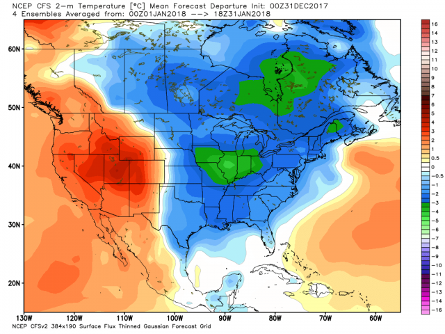
The CFSv2 retrogrades the coldest in the first half of February.
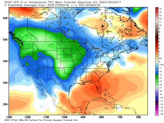
For those tweeting this is a local cold and the rest of the world is very warm, that is as we have been forecasting relative of course -20F versus an normal of -25F is warmer than normal but not warm. Indeed it is likely welcome. We forecast these areas would cool down by mid January as the early stratospheric polar warming takes place favored in east QBO low solar years. Here is day 16 of the GFS. It shows that cold air now building over the snows as the arctic warms.
.png)
Happy New Year’s everyone. Wishing you a happy, healthy and prosperous 2018.
Please make wise decisions tonight if you are in the coldest areas. This is dangerous cold.
