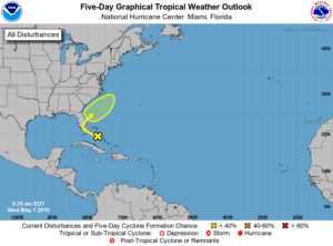
A trough of low pressure located over the northwestern Bahamas is
producing disorganized shower and thunderstorm activity. Little
development is expected during the next couple of days as the
system moves generally northwestward toward the Florida Peninsula.
Subsequently, some slow development is possible as the disturbance
turns northeastward and moves over the western Atlantic.
Regardless of development, locally heavy rains are possible over
portions of the Bahamas and the Florida Peninsula during the next
couple of days. The next Special Tropical Weather Outlook will be
issued by 10 AM EDT Thursday, or sooner if conditions warrant.
* Formation chance through 48 hours…low…near 0 percent.
* Formation chance through 5 days…low…20 percent.


